As the lockdown restrictions begin to creak open here in Ireland, it’s time for me to continue my exploration of my new homeland, something that’s been on hold for about half the time that we’ve lived here.
The map on my office wall show shows me that I’ve seen quite a bit of the coastlines of counties Clare, Kerry and Galway, and so it was time to look a little further afield. I’d seen the occasional picture of Benbulben and the Gleniff horseshoe, and the pins dropped on my GoogleMap of places to visit featured quite a dense cluster around them in County Sligo.
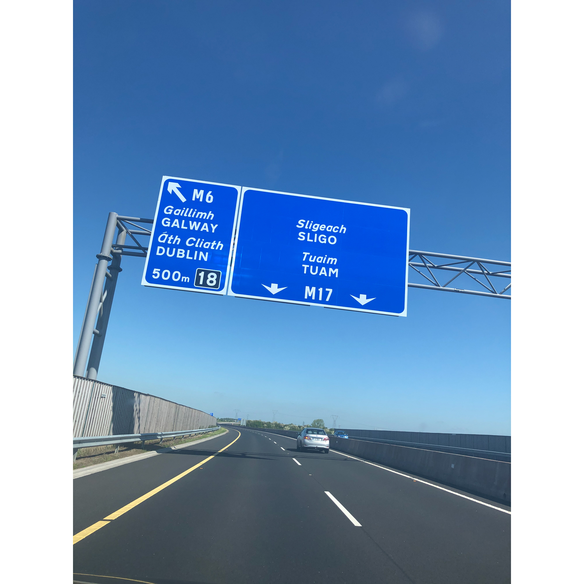
I booked three days off work and three nights in an AirBnB close to the village of Grange. I packed a kayak, a pair of walking boots and a sense of adventure and headed north…
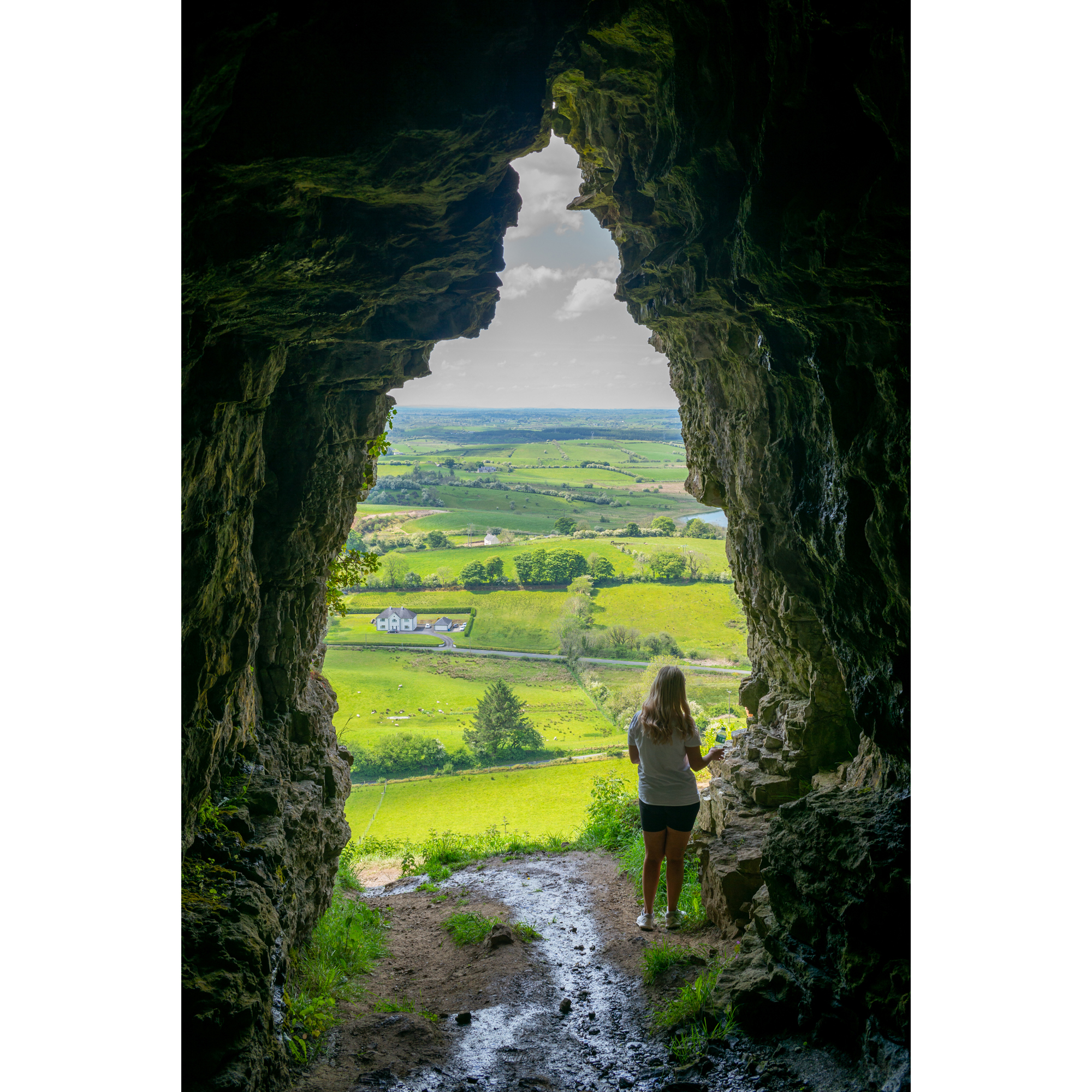
On the way up, I stopped off at one of those dropped pins that was close to my route – the Caves of Keash. This is a 3km out and back trail that crosses farmland before rising quickly up a hillside to a limestone cliff that is full of caves and cracks. Many of the caves are interconnected and large enough to walk through. It was a rightly popular spot on a sunny Sunday afternoon.
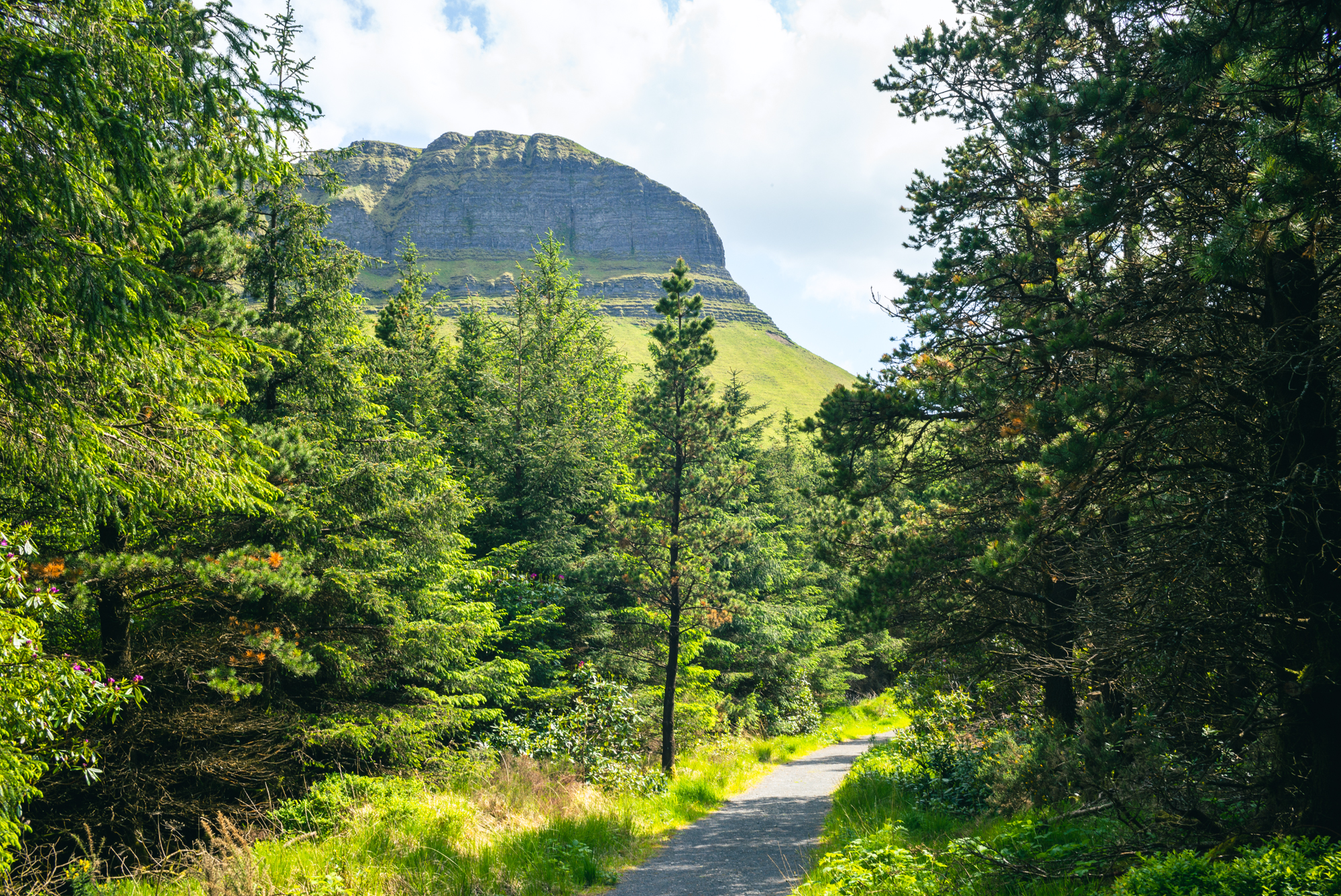
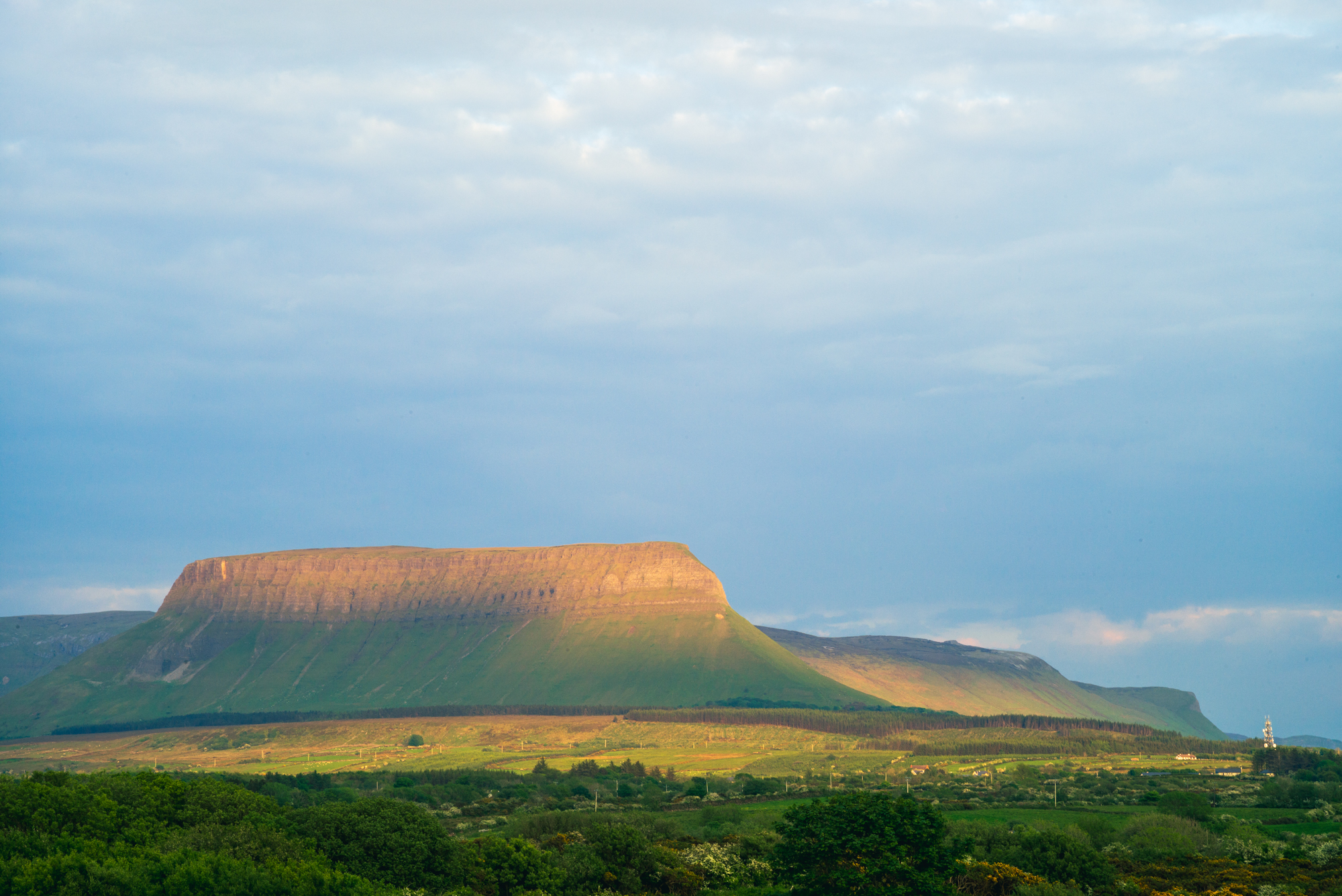
Another stop-off, along with W.B Yeats’s grave at the Drumcliffe Cemetery, was the forest park that sits at the foot of Benbulben. It was my plan to walk on the plateau the next day, but exploring these trails in the shadow of the unique, flat-topped hill only built the anticipation for what was to come.
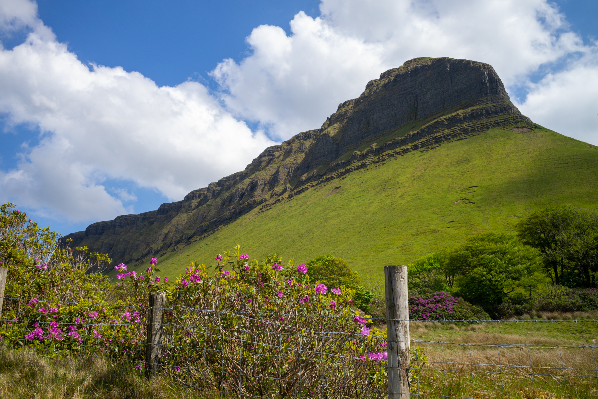
The mountain dominates the scenery in this part of Ireland and is instantly recognisable. The view from my accommodation was of the north-west flank of the mountain and as the sun set, it turned it a beautiful orange.
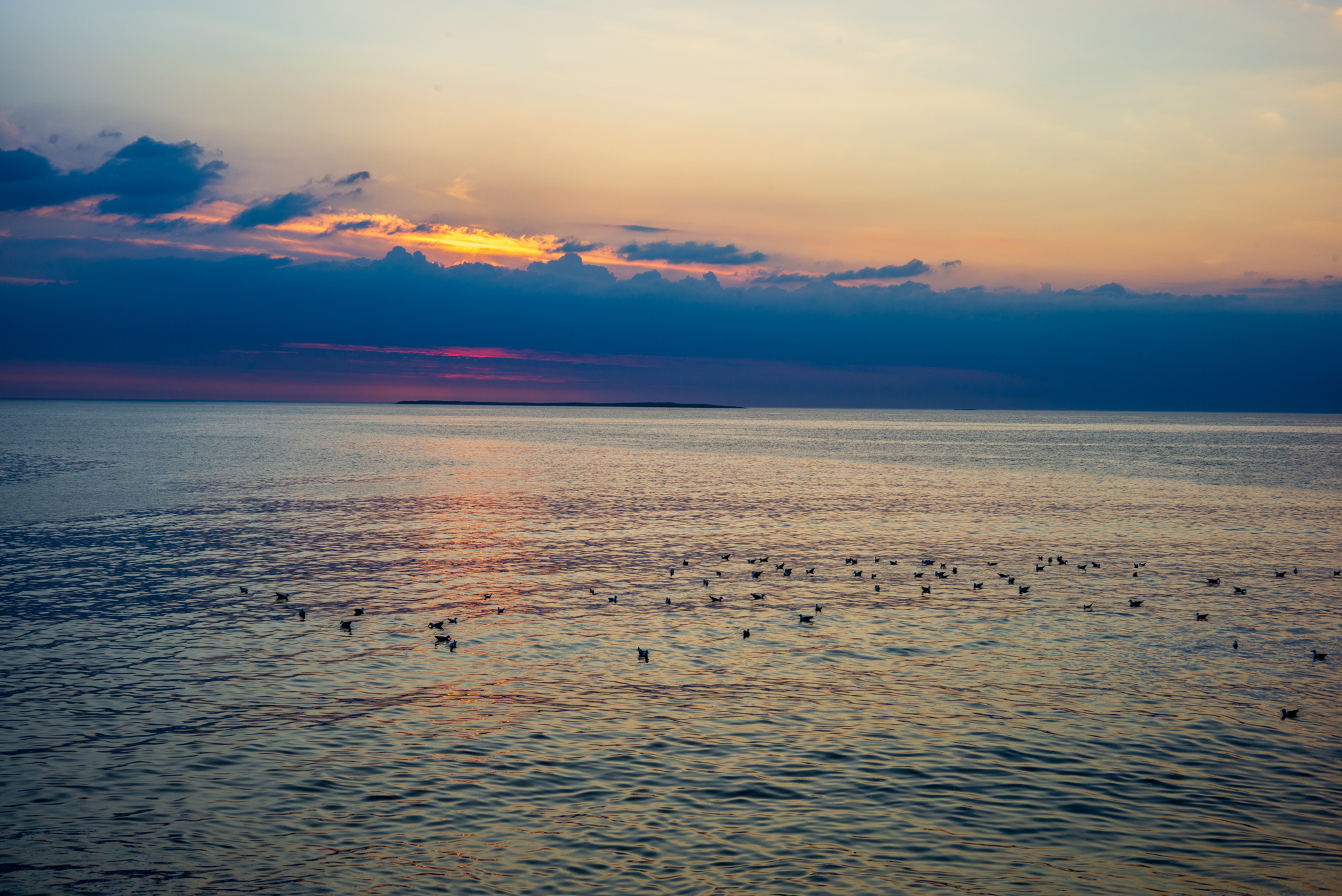
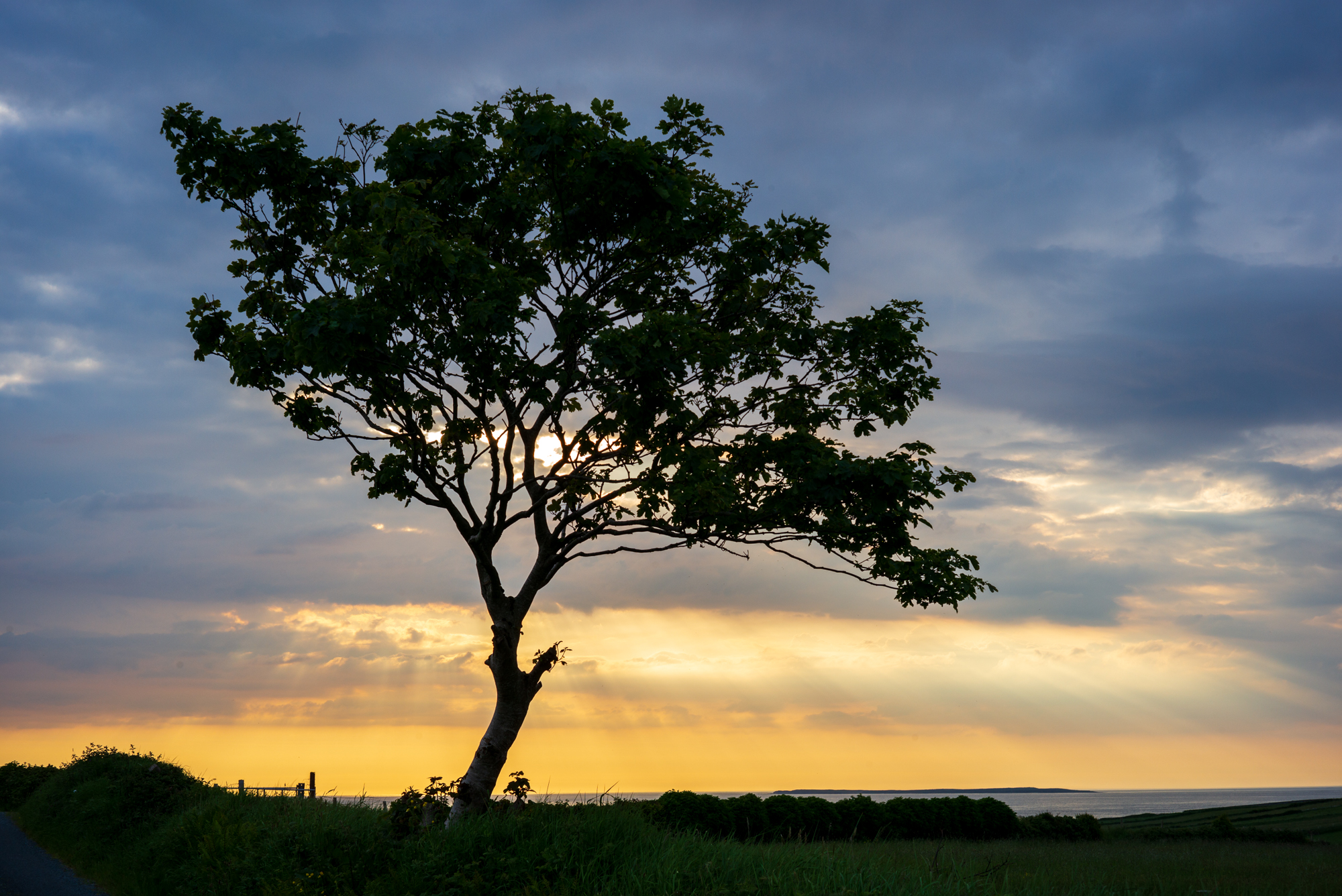
Even better, I was staying 500m from the sea, and so able to explore the area in the blue hour, after the sun had made its spectacular departure.
The following day started the way the previous one had ended, with the sun playing a starring role. I ate a quick breakfast looking out at the mountain that I was so excited to be climbing. A short drive to Luke’s Bridge and what is the standard start point for many ascents of Benbulben.
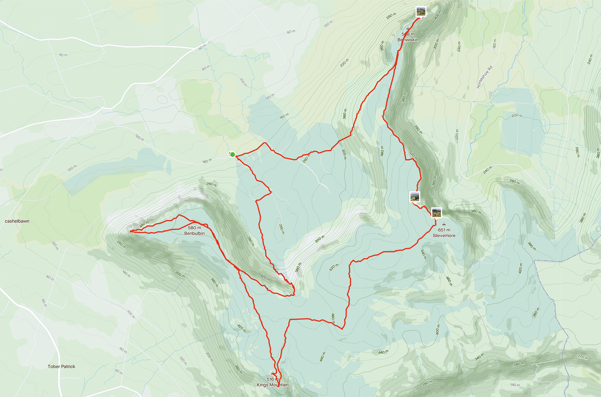
My plan was to spend some time on the plateau after making the climb. Once the hard part was over, I thought I’d take advantage of the flat summit and the views out from it.
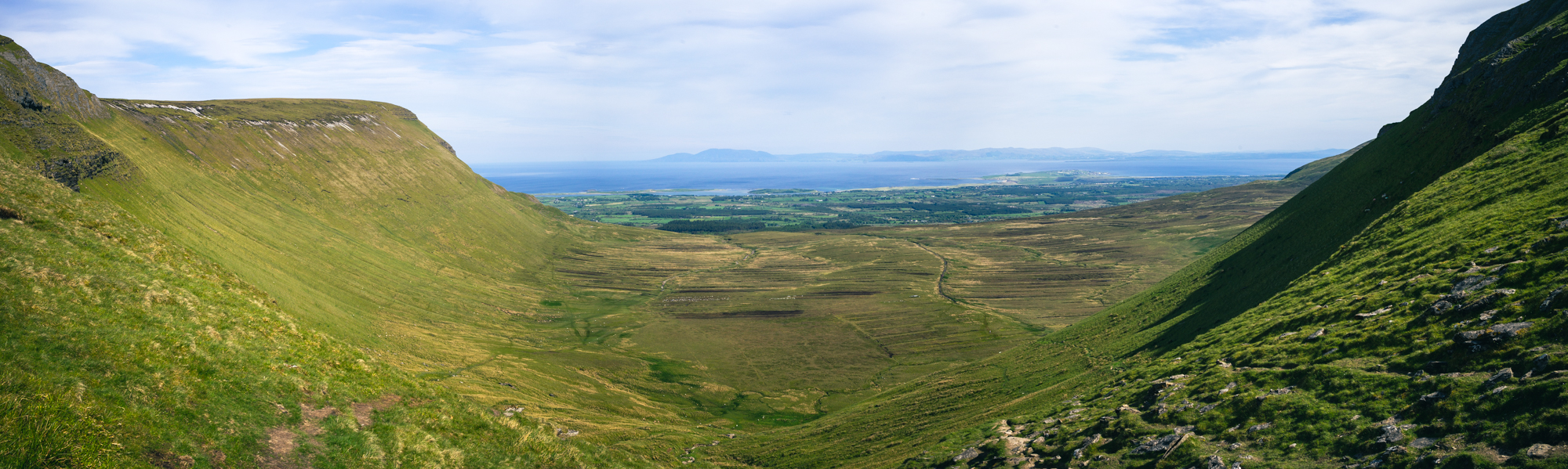
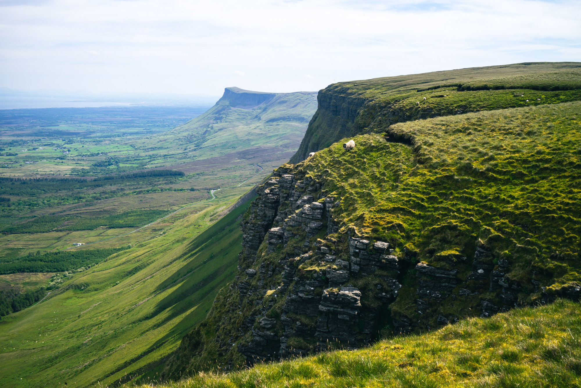
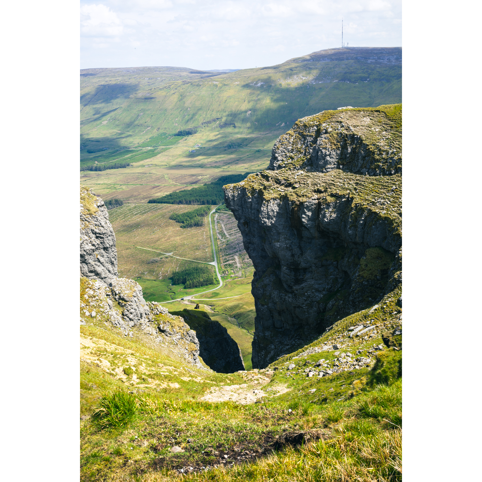
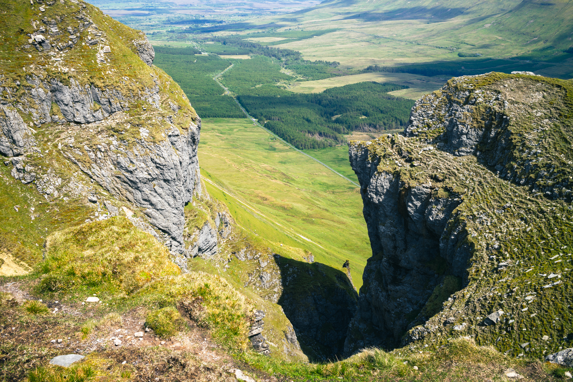
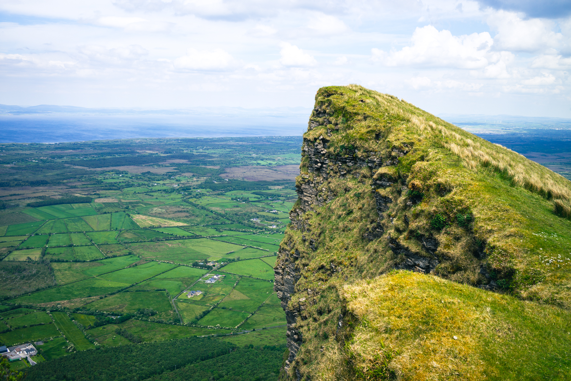

My route covered more that 22km on a hot, sunny day. I’d completed my plan to take in the ‘royal’ peaks (Benbulben, King’s Peak, Slievemore and Benwiskin) but was tired, and the steep final descent was pretty painful. The dry weather before my trip meant that the peat bog across the top of the plateau was firm enough to walk over, but it still wasn’t easy going.
Knowing what I know now, I’d have left out the King’s Mountain summit, perhaps saving it for another day and an ascent from the south. The detour out to it added several kilometers across some of the toughest terrain.
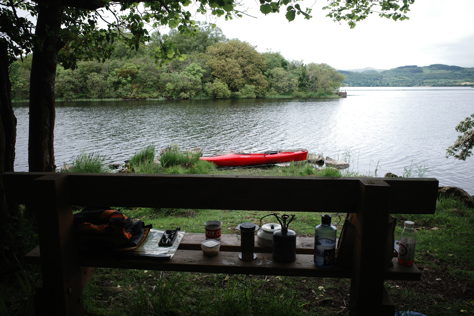
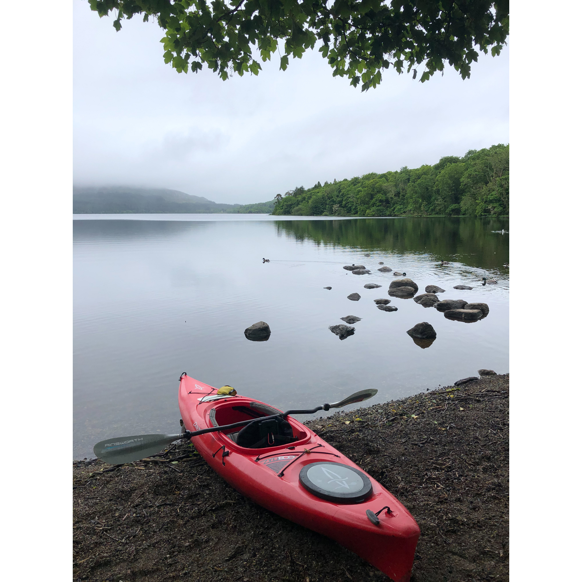
Knowing that my legs might be complaining after the previous day, and having seen a forecast that promised a morning of low cloud and drizzle, the plan for my day two was to take a paddle on Lough Gill, close to Sligo town. I called in to Call of The Wild in Sligo on the way – an excellent outdoors shop that I wish was closer to home, but for the sake of my wallet, am glad that it isn’t.
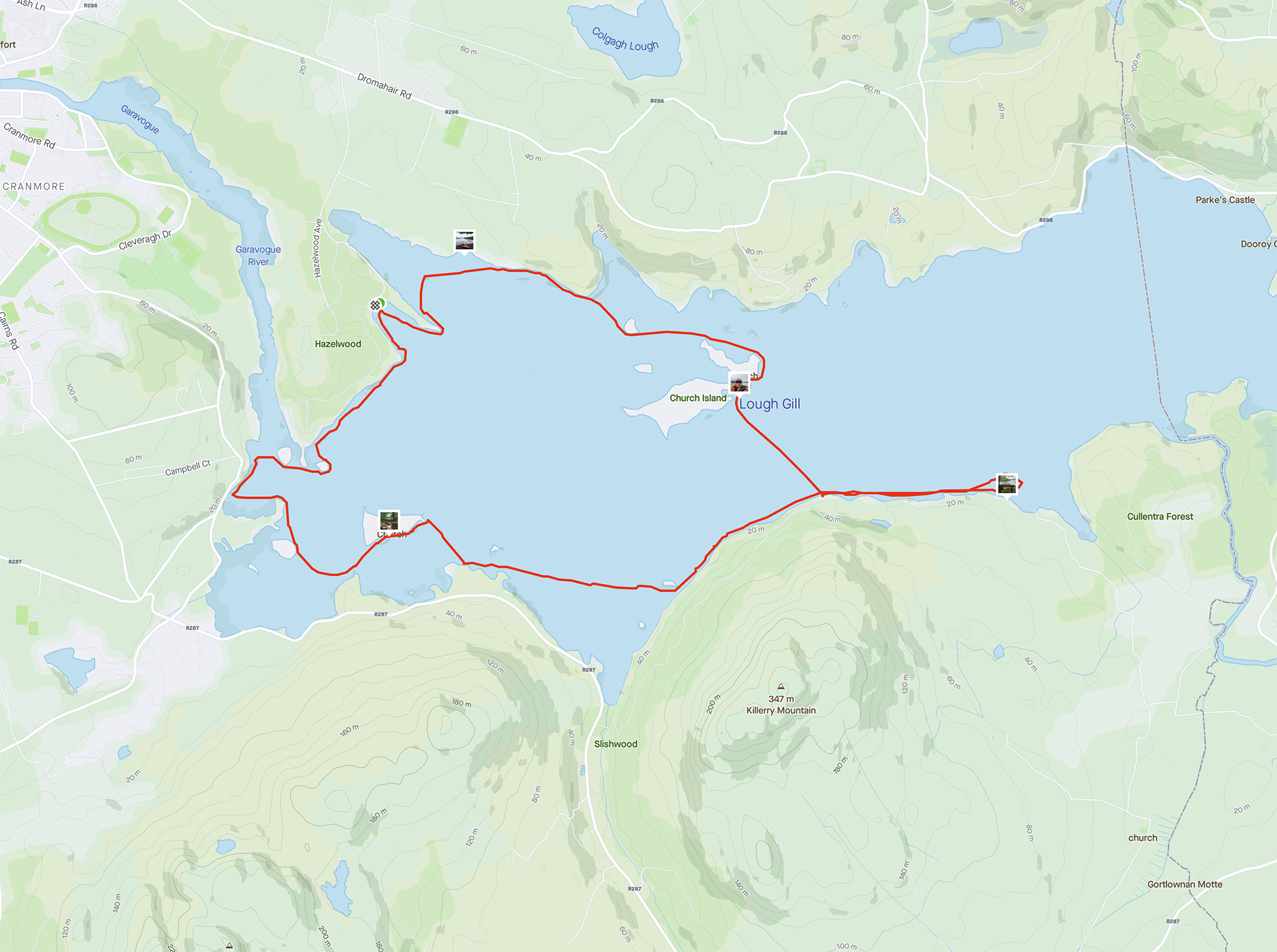
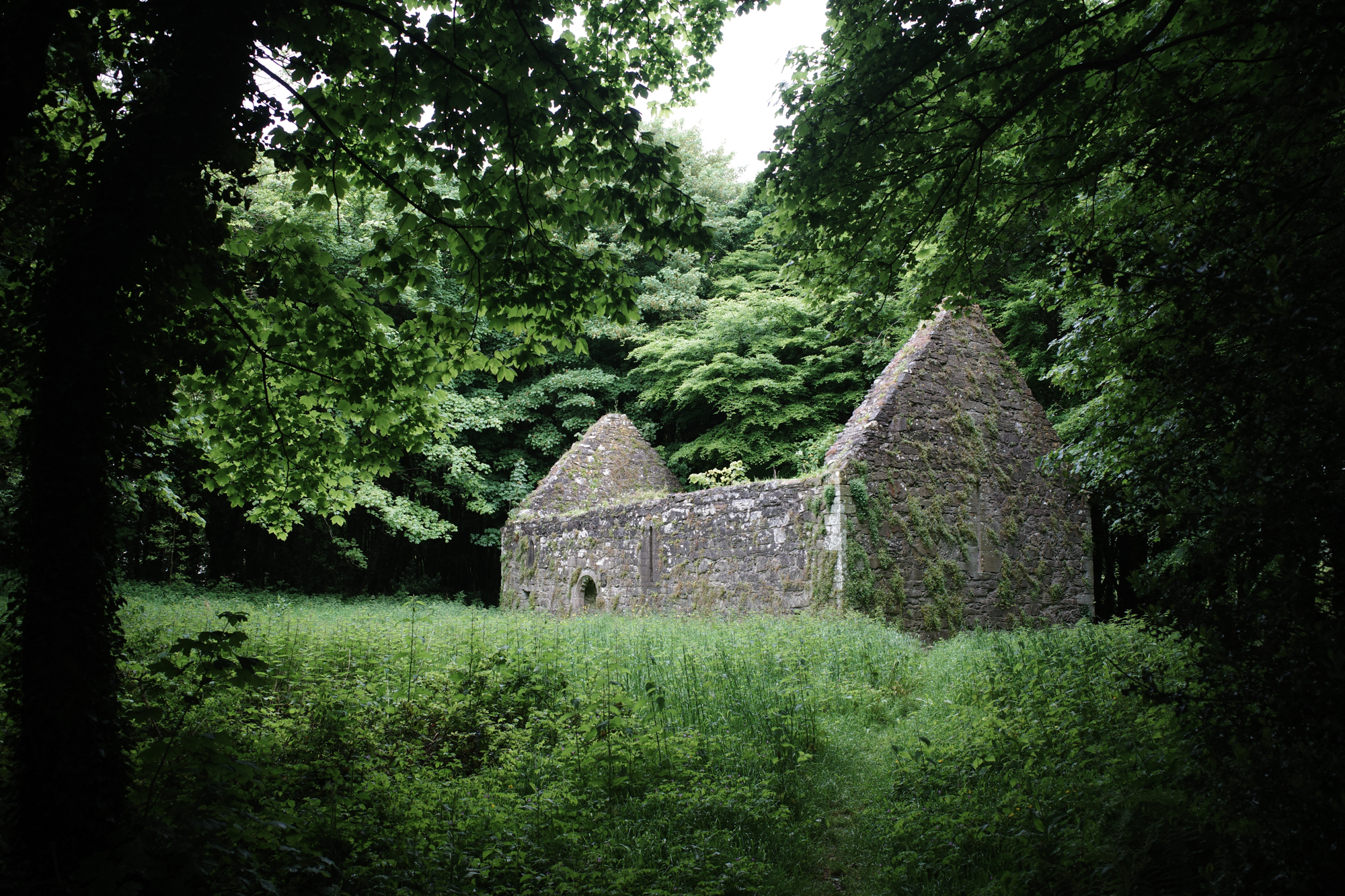
Lough Gill is a beautiful lake with views of the mountains I’d climbed the previous day, and mixed forests stretching down the hillsides to the shore. I planned a route that would explore the western end of the lake and the edge of the Hazelwood forest, before working my way east and stopping off to explore a couple islands on the way back.
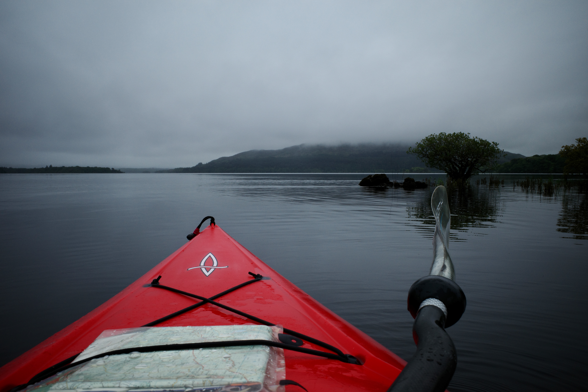

I’d read about Innisfree, a small island mentioned in the Yeats poem (below), and so as conditions were good, I extended my exploration and took in a circuit of it, before stopping for coffee on the shore close by.
I will arise and go now, and go to Innisfree,
And a small cabin build there, of clay and wattles made;
Nine bean-rows will I have there, a hive for the honey-bee,
And live alone in the bee-loud glade.
And I shall have some peace there, for peace comes dropping slow,
Dropping from the veils of the morning to where the cricket sings;
There midnight’s all a glimmer, and noon a purple glow,
And evening full of the linnet’s wings.
I will arise and go now, for always night and day
I hear lake water lapping with low sounds by the shore;
While I stand on the roadway, or on the pavements grey,
I hear it in the deep heart’s core.
The Lake Isle of Innisfree
BY WILLIAM BUTLER YEATS
Another fantastic day out. Despite a little drizzle and an increasing wind, the peacefulness of the surroundings and beauty of the lake mean that it’s a paddle that I’ll remember for a while.
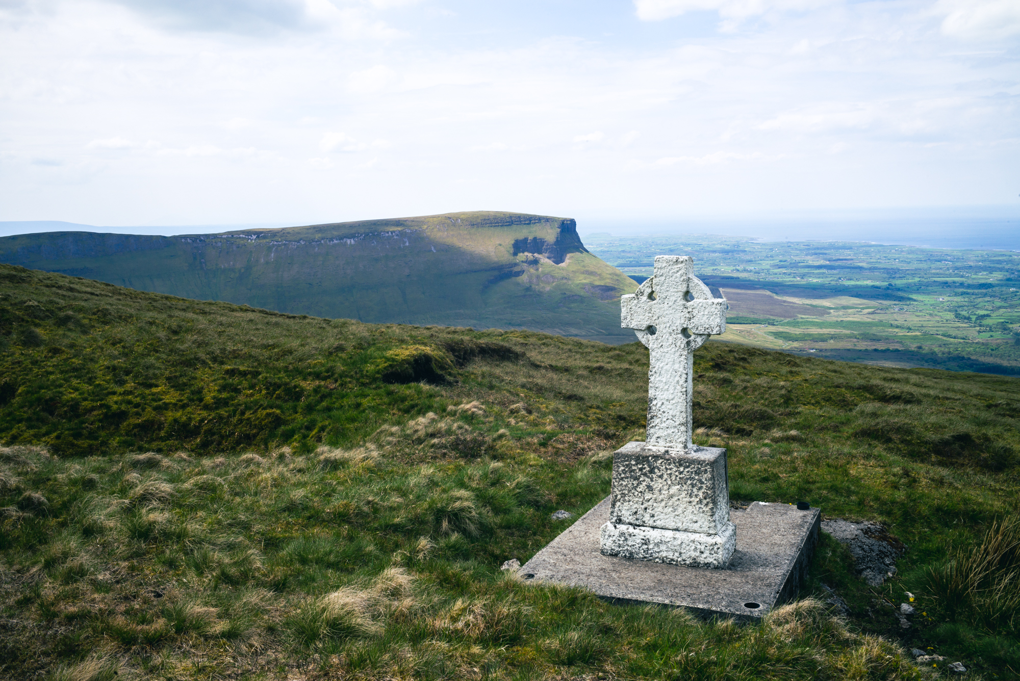
Time to check out and head home, but not before taking a quick walk that would allow me to tick off two more Irish ‘county tops’.
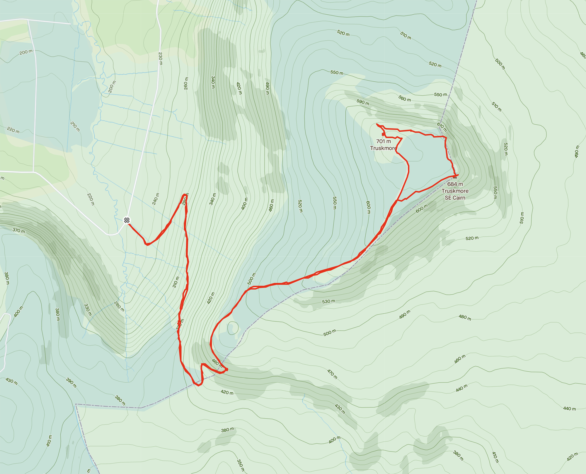
Truskmore is another peak that’s obvious from a long distance away – Benbulben has it’s tabletop shape, and Truskmore has a large television tower on the top.
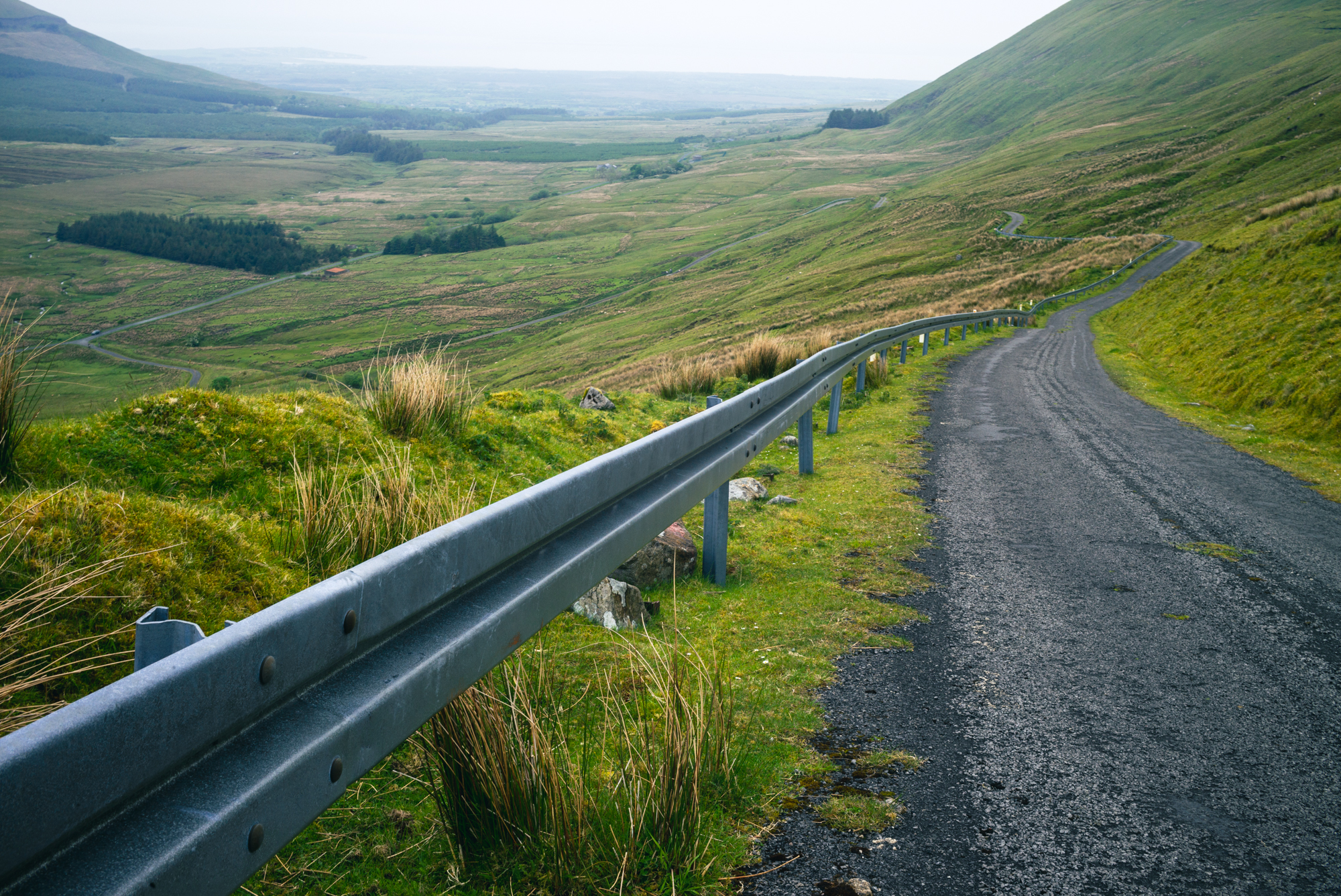
I drove into the Glenniff horseshoe and looked up at the ridge-line that I’d walked two days previously. On a quiet weekday morning, I was the only person in the valley and stopped off for all the usual, tourist snaps.

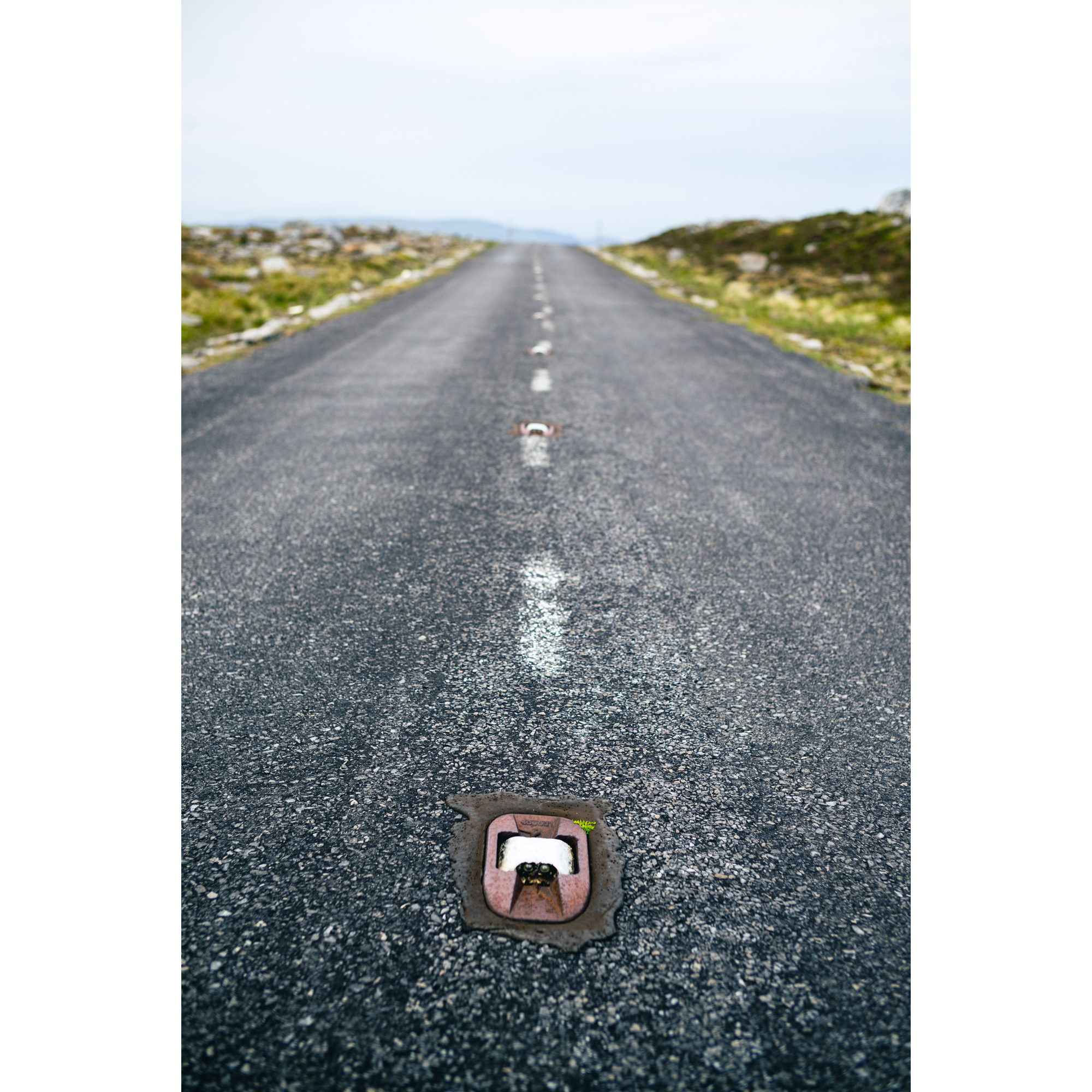
Having a TV tower on top means that Truskmore has a service road running up it. It meant a fairly dull, out and back route, but the views more than made up for the lack of navigational challenge.
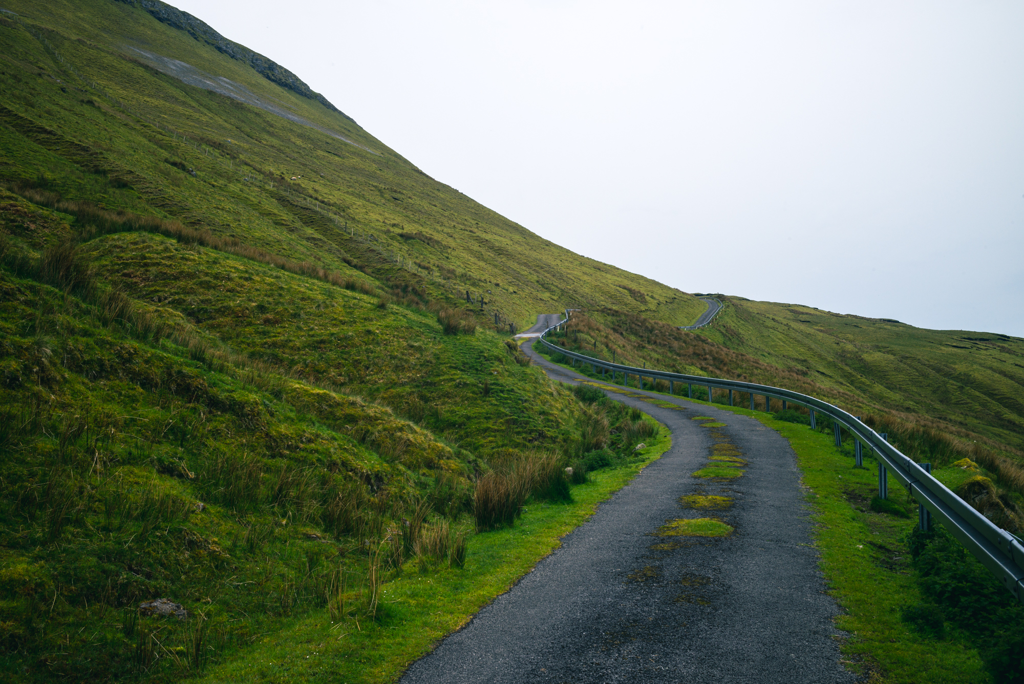
The road up reaches 1 in 4 in places and averages 10%. Learning that people ride up this climb in 18 minutes was impressive. (Strava segment).
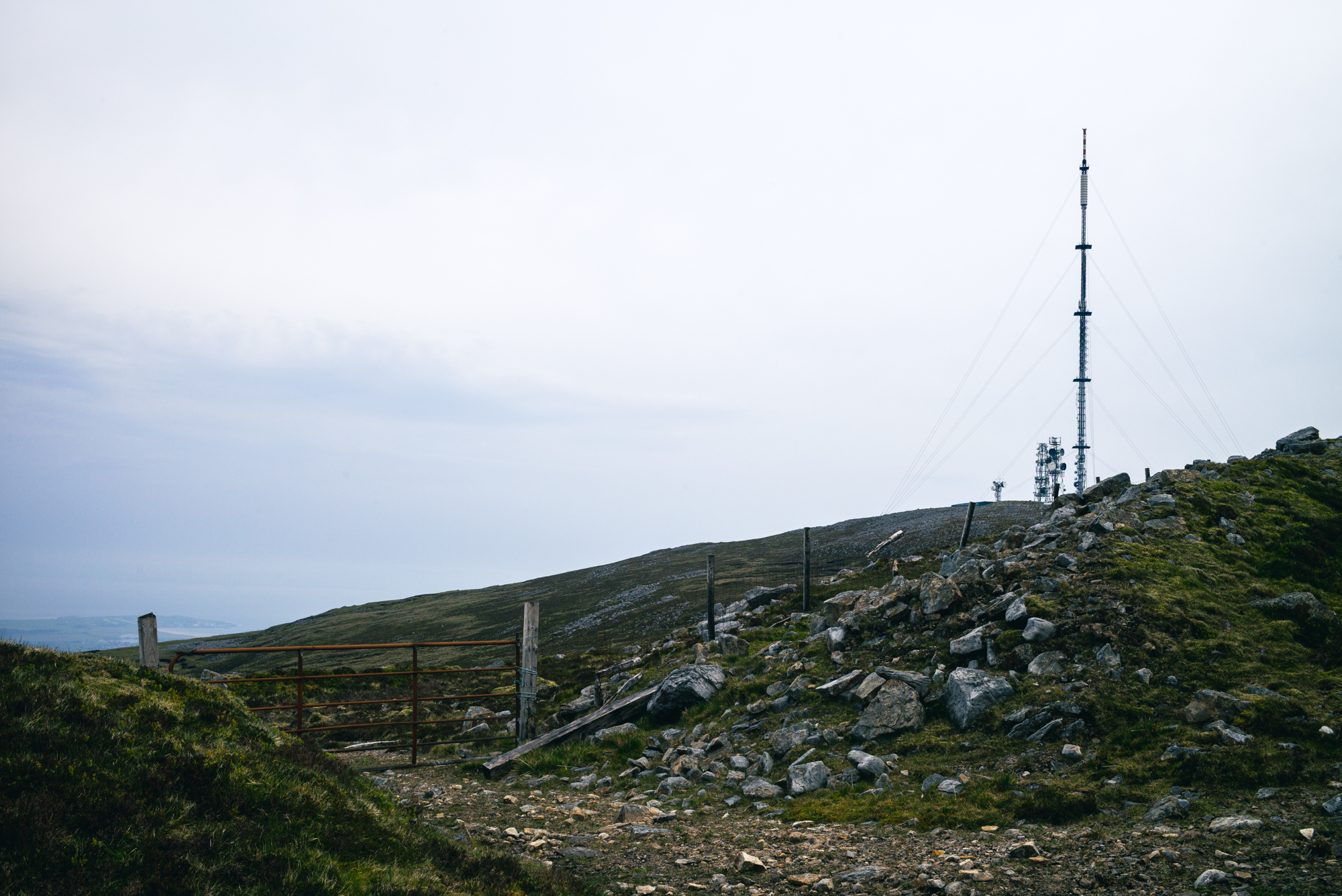
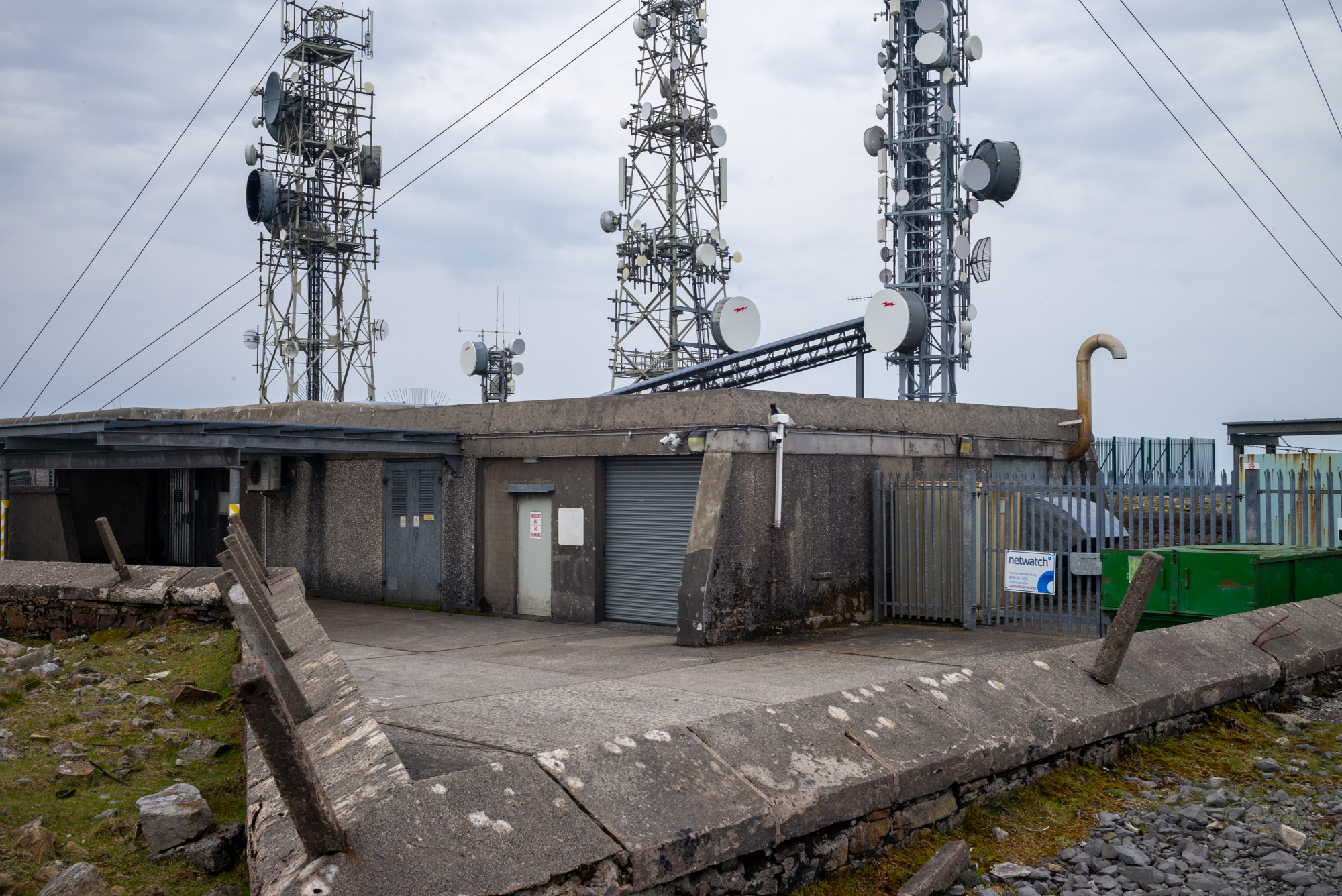
On top, a concrete bunker and tangle of cabling and fences howled in the wind. The place looked pretty weather-beaten and I can understand why. The floor across the whole hill was littered with large cut-off cable ties. Presumably the mast-monkeys who work on the towers just cast them into the wind as they remove them from the cabling high above. Seems ridiculous in a place so beautiful.
Close-by, a trig point marked the highest point in county Sligo at 701m.
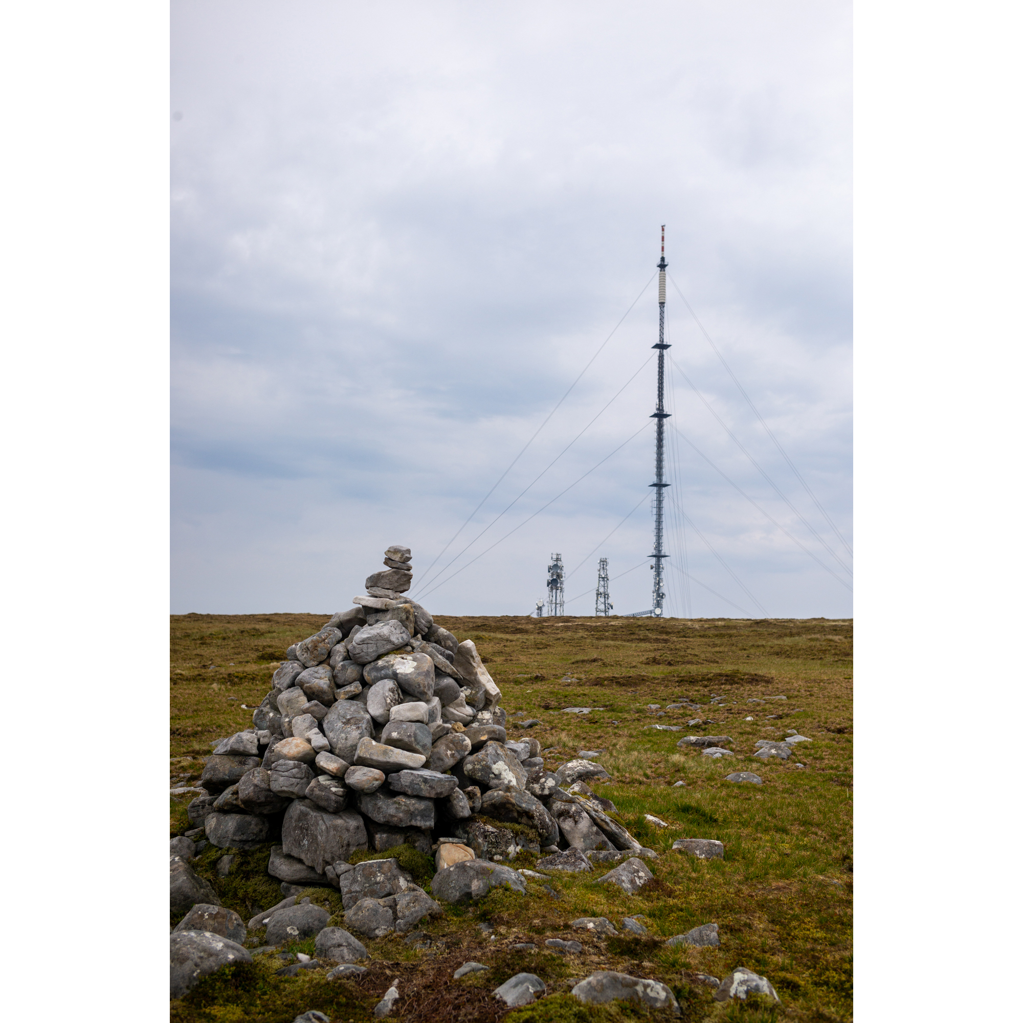
A couple of hundred meters away, across the windswept summit and a county boundary, a small cairn marks the highest point in County Leitrim (684m).
Tick.
I drove home with aching legs and weary arms, but dopamine and endorphins gave me an all-over glow. I vowed to get outdoors more often and to continue to explore Ireland again now that the opportunities are returning.
Back in England, if I’d wanted this sort of scenery and isolation, I would’ve had to drive for many hours. Here, these wild landscapes are all around and this adventure is available whenever I can break the draw of the settee…

What a journey!
LikeLike