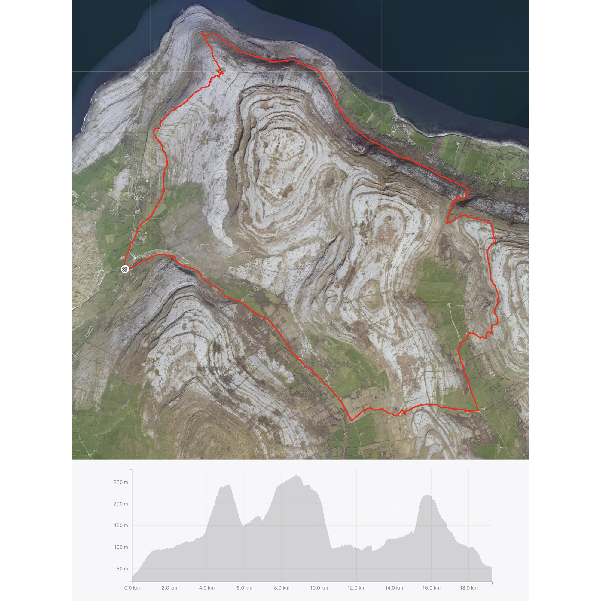
Another week locked down in County Clare (which is in no way a bad thing) and another chance to get out for a walk in the Burren. Last weekend, I walked the Caher Valley Loop which is the first part of a longer trail, the Black Head Loop; I completed the second part today and thought I’d share the pictures.
The full Black Head route is 26km, with three notable ascents and descents as the trail crosses from valley to valley, over higher ground. Last weekend was 15km and included one of the climbs, so I figured a similar distance today and a couple of climbs – it didn’t quite work out like that as you’ll see later…
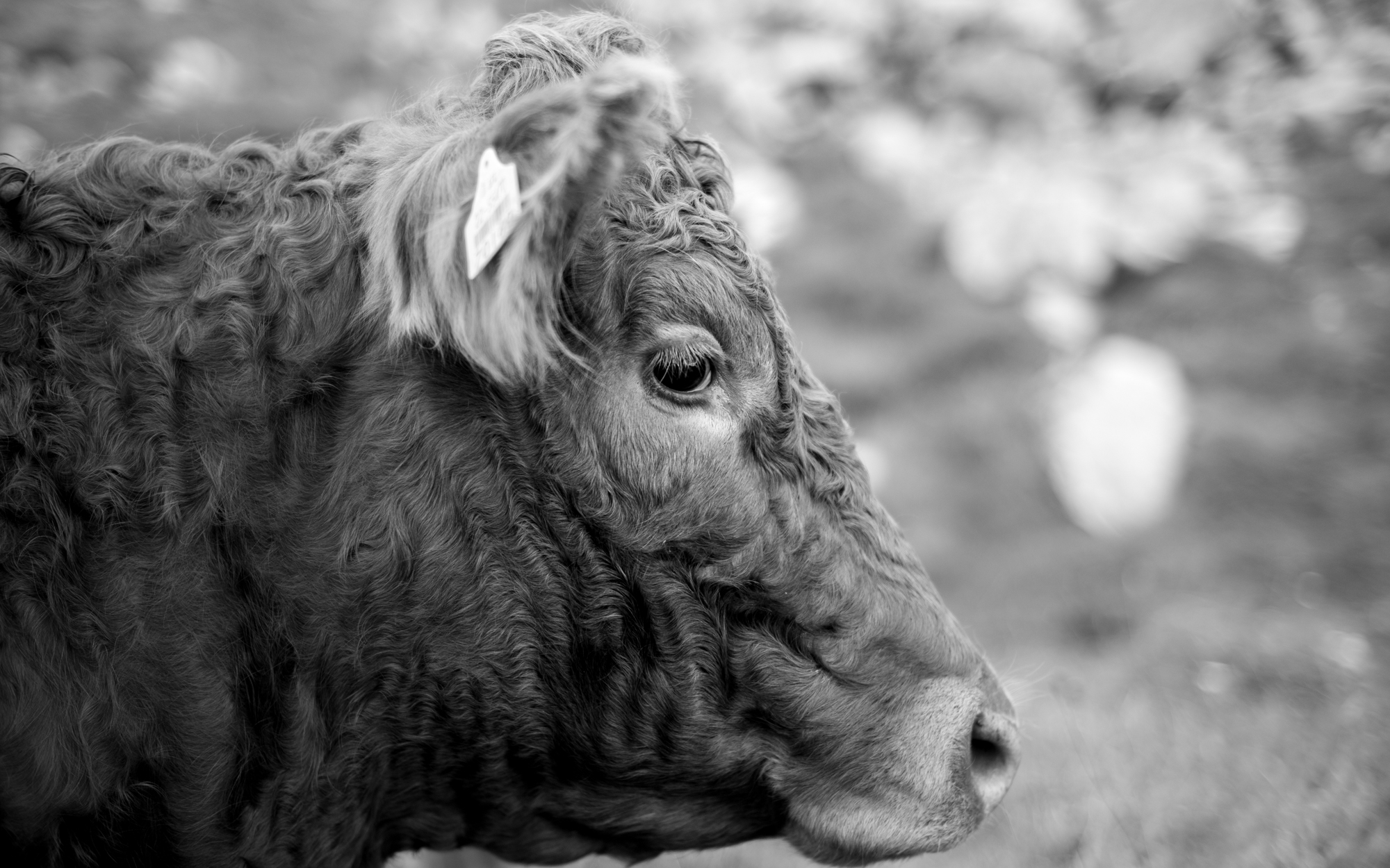
I explained a little about the Burren in last week’s post but in case you missed it, the Burren is a unique karst landscape of exposed limestone hills. Its position close to the Atlantic ocean means that it catches a lot of weather, but because of the porosity of limestone, there are no (overground) rivers in the green valleys. These fertile areas at lower altitude are given over to grassland for beef farming. Burren beef commands a high price and most of the cattle raised here will be exported as live animals.
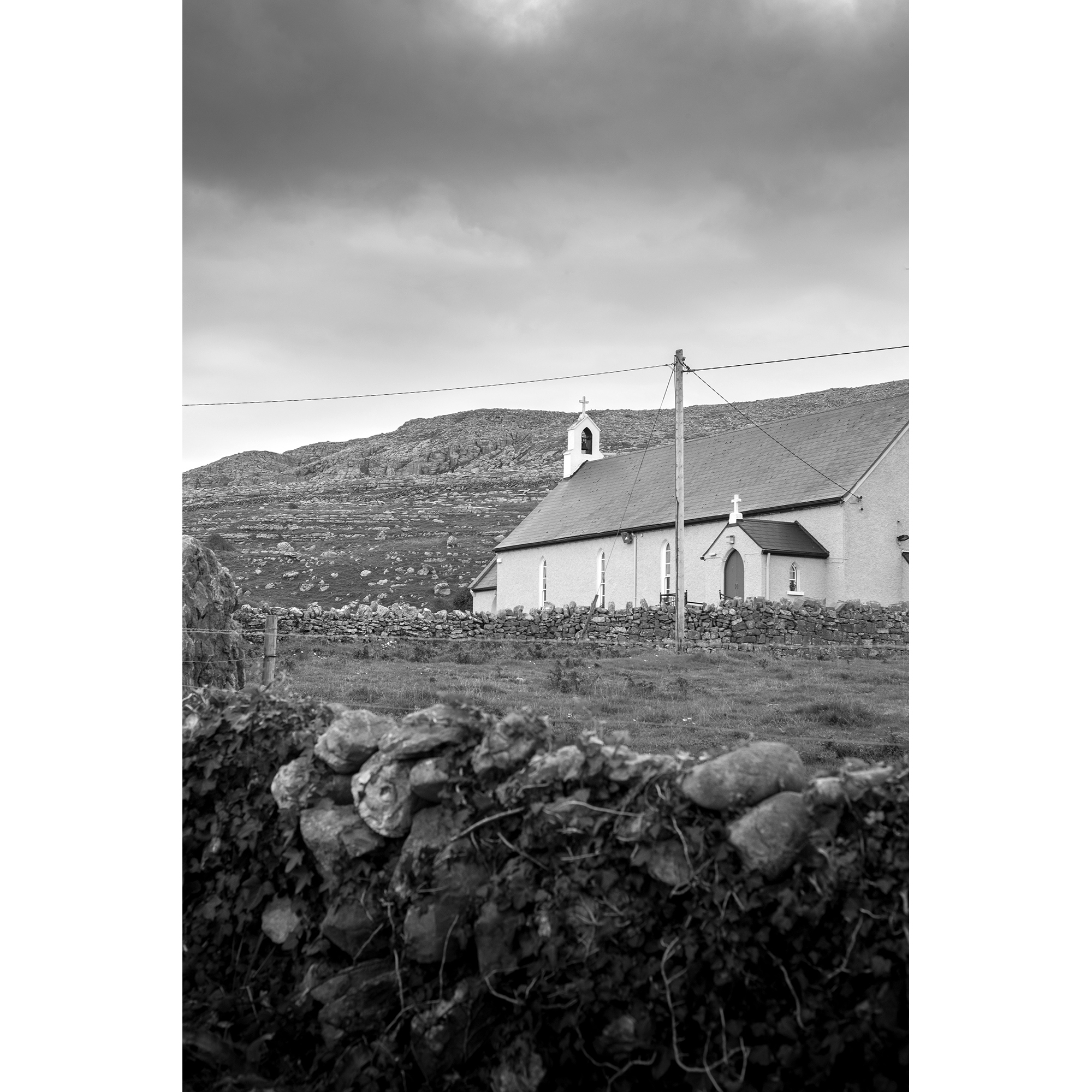
Once more, I parked in Fanore but this time, walked back up the valley that had been the end of my walk last week. Back past the former Royal Irish Constabulary barracks, St. Patrick’s church and alongside the babbling Caher river.

The first four kilometres were a gentle ascent along a quiet road, crossing the only overground river in the area on a couple of occasions. At Formoyle, I took a left turn onto an unsurfaced track; my heart rate increasing with the gradient.
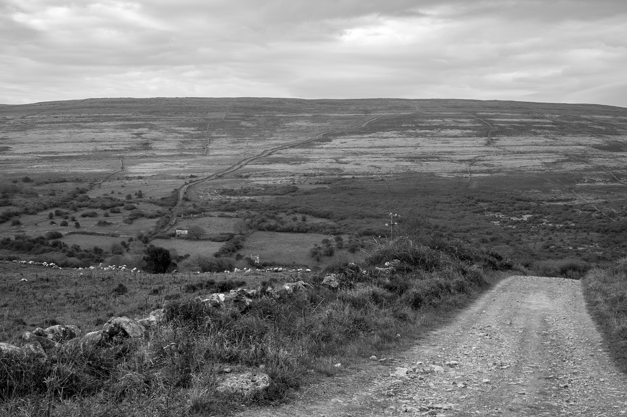
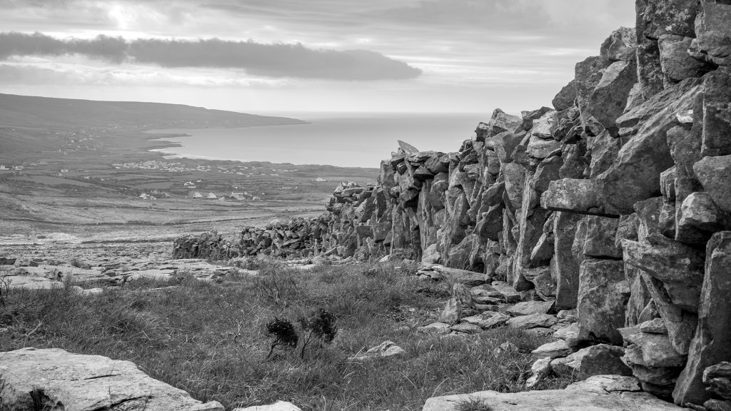
As I climbed, there was a good view back across the valley to my descent on last week’s walk. The parallel walls of the ancient ‘green lane’ (used for droving animals) were obvious.
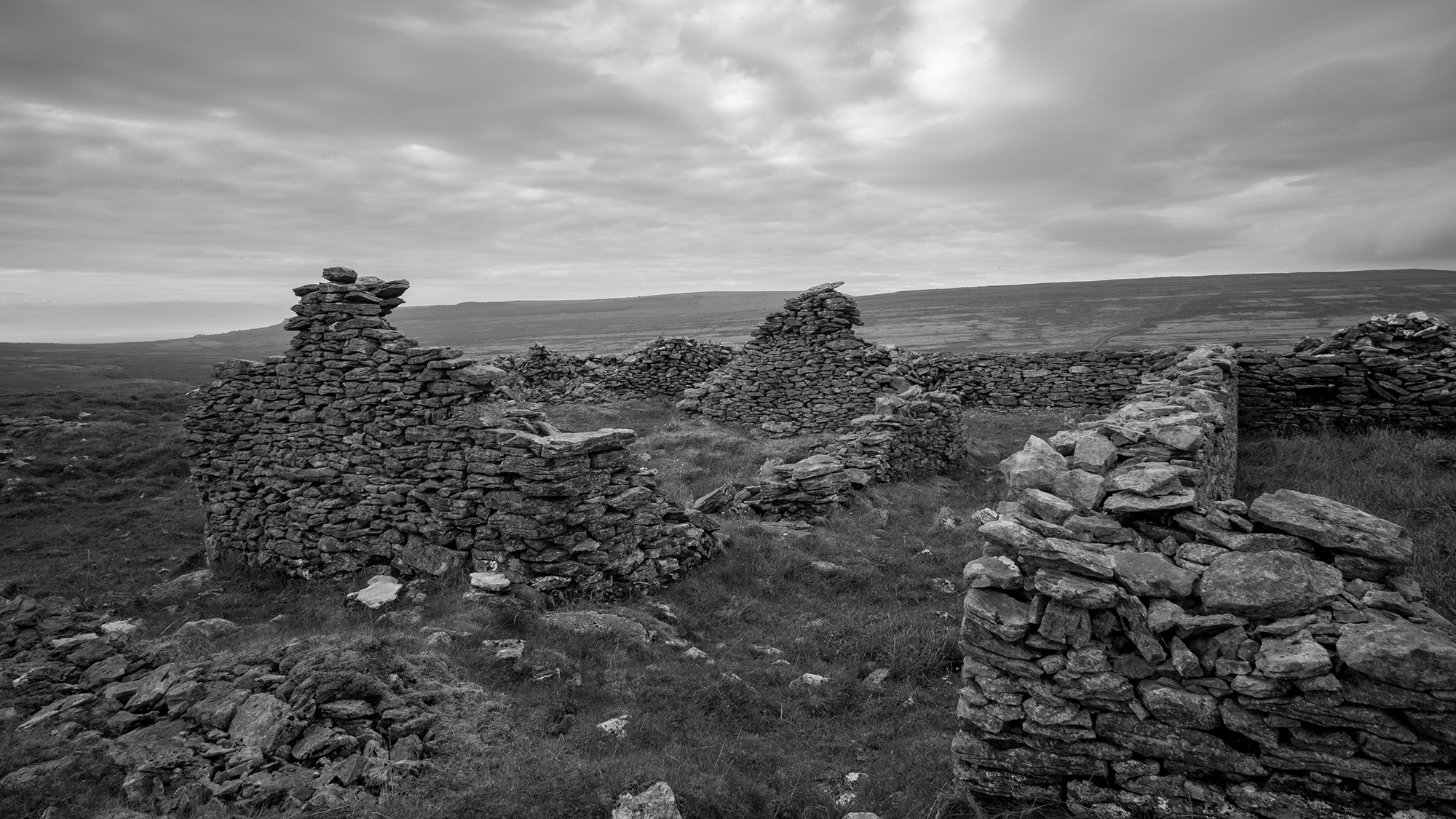
At the top of the slope, and the top of the pass between the Caher and Rathborney valleys, is the Cathair an Ard Dorais (‘the fort of the high door’) ring fort. It is unusual as it is has two, concentric ringed enclosures. It’s thought that the richer folk would have lived in the inner circle, and the poor in the outer. Many of the original walls remain intact, and have been added to in more recent centuries. There are the remains of both a chapel and an illicit drinking house (a shibeen) side by side, dating from the nineteenth century.

After the descent from the fort, I turned north in the valley bottom and passed through more grazing land before starting the next climb up the side of Cappanwalla. I met a couple of other groups of walkers on this stretch, demonstrating that this loop is a popular one, although as with last week, preference seems to be to walk it in the opposite direction to me.

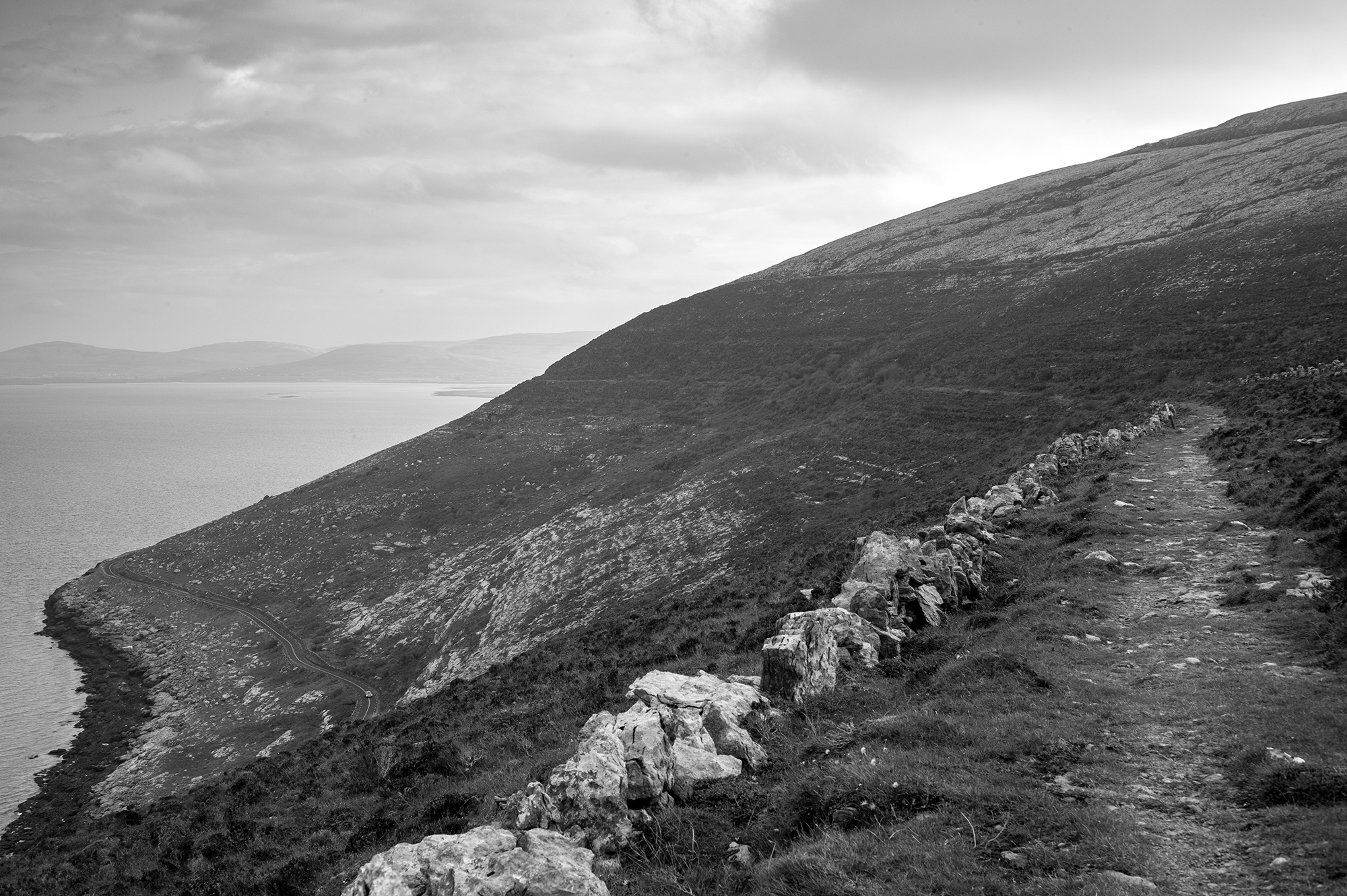
After the ascent to about 250m, the path contours the side of the hill for a couple of kilometers before rounding the north-west shoulder of the hill. Here, the mountain suddenly drops sharply down to the sea and a spectacular view opens out across Galway Bay to Connemara and Galway city – at least it would if the weather had been more kind.
I stopped for lunch anyway and imagined what I might be missing.

The descent from here gets steep as it follows the mass track down towards the remains of O’Lochlann castle. The mass track is another ancient thoroughfare that took the faithful from the Rathborney valley, down to the church at Gleninagh. You’d have to be pretty dedicated to follow such a route for the Sunday service. It’s steep and slippery on a good day – it must have been horrendous during a Burren winter.

After following the track down the slope towards the sea, at about 100m above sea level a narrow gap in the hedge forms the start of the trail west and around Black Head. A huge amount of work has been done to keep this trail open as the scrub tries to overcome it, but following it is a slog. For almost three kilometres, I was slipping, stumbling and tripping across the loose rock, hidden by bracken, brambles and gorse.
The only thing that made the route bearable were the spectacular views opening up in both directions along the coastline. The sun even made an appearance at this point as if it knew that my mood needed a lift.
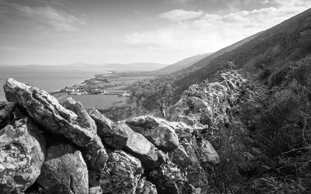
And then it’s over. The narrow path suddenly opens out to another green lane, the ancient route around the headland used before the modern road was installed close to the sea. The views continue to get better until the point when, high above the Black Head lighthouse, the view south towards Fanore and Doolin opens up. It’s a very special place.

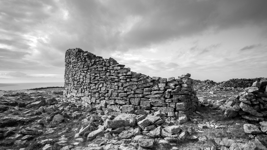
I could see on the map that there was a stone fort 150m or so above me and imagined that the views there must have been even better, so I took a sharp left and headed uphill across the limestone slabs. Sure enough, as I panted my way upwards, the spectacular stone structure of Caherdooneerish appeared. As with most of these ancient Irish buildings, there are all sorts of accounts of their history. In this case, an information board explained that it was shelter and sanctuary for farmers, their families and cattle and dated from the early centuries AD. There’s another more flowery account of its history here.
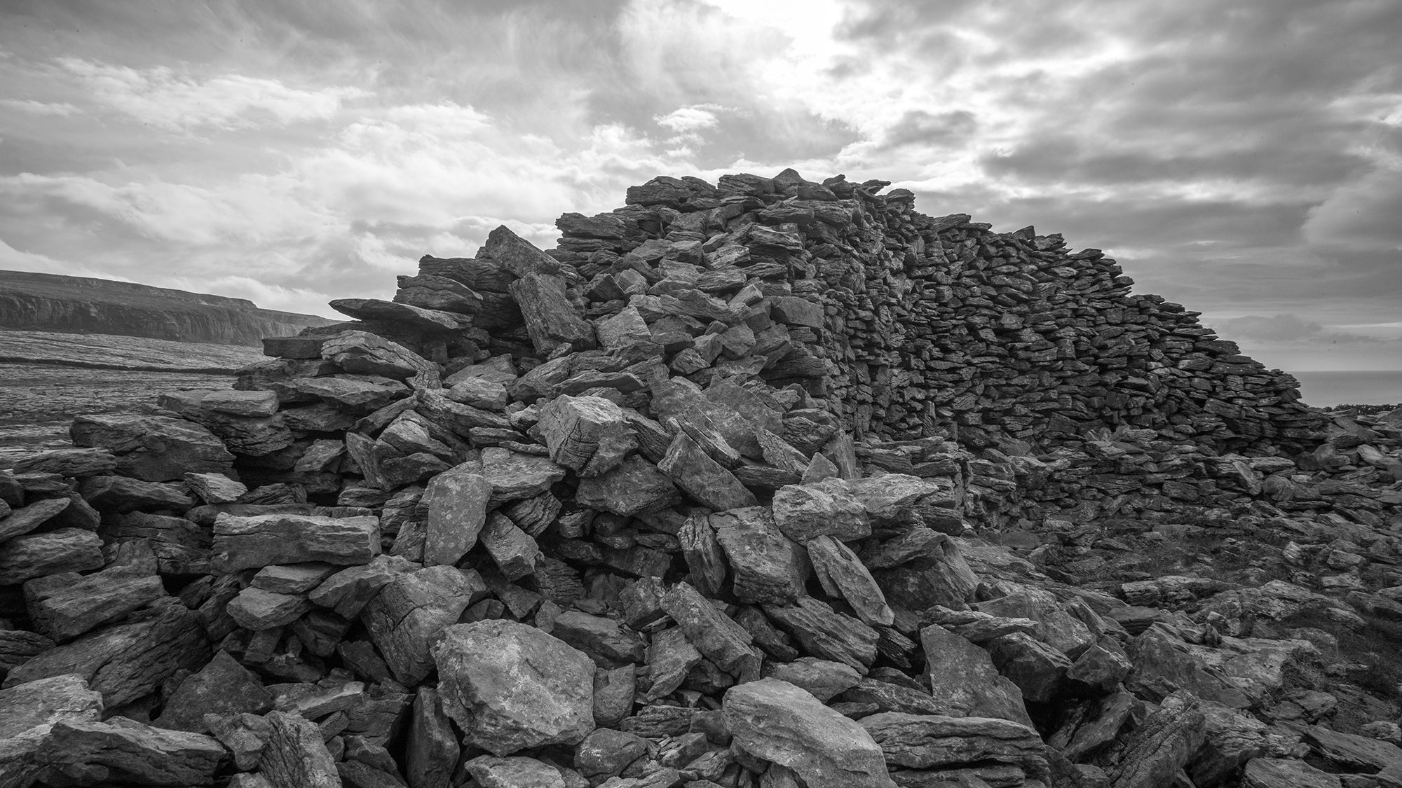
Whatever its history, it is an amazing structure and one cannot imagine the effort involved in building it to withstand the Atlantic weather for so many centuries, but also what it must have been like to rely on such a pile of rocks for sanctuary from either the weather or marauding hoards. (As I made my way up to the fort, pushing on my knees as I went to ease the gradient, I was muttering ‘charge’ under my breath, again imagining the impossibility of attacking the fort having just parked my longboat on the shore.)
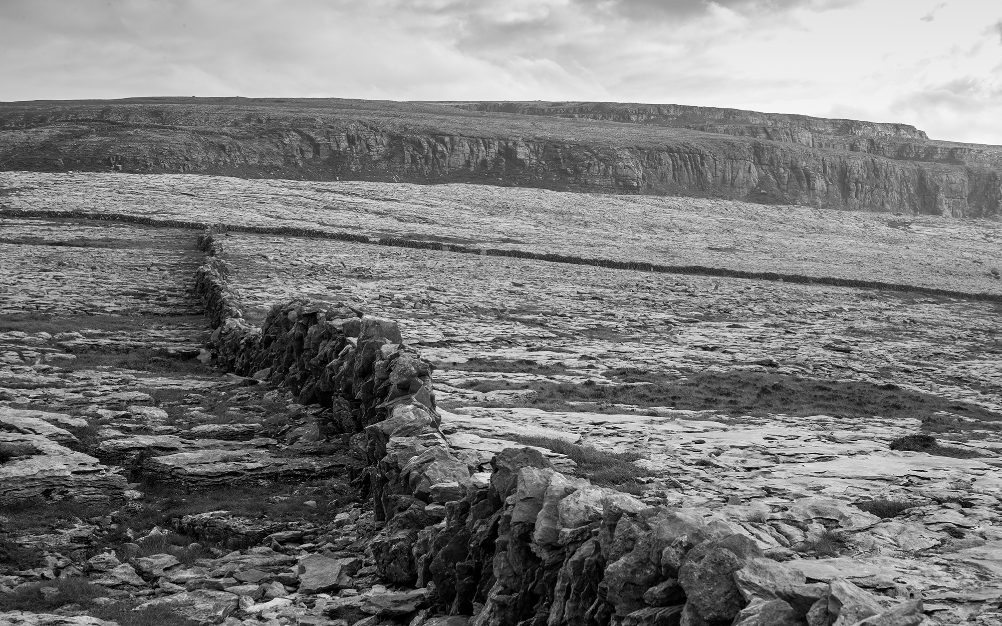

All that remained was to finish off my sandwiches in the shadow of the fort and to begin the descent back towards Fanore. There is very little vegetation at this altitude in the Burren, and so one can pick one’s line across the countryside, walking across the limestone clints, but being careful to avoid the grikes.

Remember that stream that I walked alongside at the start of the outing, five hours earlier? Well, I did. So I grabbed a towel and spare shoes from the car and went and treated my feet to a dip in the river after I took off my boots.
Grand.


Strava links:
Caher Valler Loop
Black Head Loop

What a walk! Amazing views and I won’t lie, I felt a bit chilly after seeing the image of feet in the water… 🙂
LikeLiked by 2 people
Thanks for looking as always. It was just what my feet needed!
LikeLiked by 2 people