Following Ireland’s return to ‘level 3’ lockdown, we can no longer travel outside of the county in which we live, apart from in special circumstances. The government has also promised that they are ramping up the level of enforcement to try to slow the ‘second wave’, which has meant increased Garda checkpoints, especially on the major roads that cross county borders.
While it might be some time before I can repeat last week’s trip to Counties Kerry and Cork, luckily enough for me, County Clare has plenty to offer. I could spend a day walking in the Burren and not break any rules.
It can be argued that the area is amongst the most unique in Europe. Large areas of exposed limestone pavement, especially so close to the sea are extremely rare. On a dry day, with a little sunshine (as much as we can hope for in the west of Ireland), the exposed rock appears white and the area’s hills appear almost otherworldly.

My current fitness means that my mountain walks are not quite as extreme as they once were, so instead I chose a more modest outing from Tony Kirby’s excellent walking guide to the area. It’s a 15km mixture of ancient cattle tracks and minor roads, but gives great views of some of the landscape that makes the Burren unique.
The start point for the walk is the bracing Fanore beach. The Burren coastline is mostly rock but Fanore is an exception and so the small stretch of sand is always popular. As it faces west, it seems to be constantly battered by the Atlantic, but that only adds to the attraction.
Today, I was the first car on the car park and didn’t hang around on the beach for long before setting off. The first four kilometers rise gently uphill from sea level to about 220m, following a quiet local road through farmland and the occasional empty holiday bungalow.

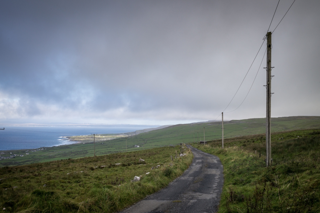
There’s plenty of history to see on the way including the ruins of a round tower house at Faunarooska, but the best view opens up behind you as you climb. Galway Bay and southern Connemara to the north, and the Aran Islands laid out to the south west.

Once off the road, the gentle climb continues along a ‘green road’. These are walled paths that have been used for centuries to move cattle across the high plateau, from valley to valley.


Along the way, there are ruins of a number of buildings. The one above was still inhabited as recently as the 1960’s and is unusual as it’s a pre-Famine dwelling, but is still around. Previously, most of these one room houses had been made of mud and so have succumbed to the weather. Some, like this, have survived because of their unusual use of stone.

There’s not a lot of vegetation above a few inches tall on the higher parts of the Burren, as there’s not enough soil for things to grow roots. The occasional exception are these Hawthorn bushes that grow on the leeward side of walls. They are sculpted into dramatic shapes by their constant battering by the weather. I imagine that they’d make decent navigational aides as they’re always pointing away from the prevailing south-westerlys.

These upright limestone slabs have been embedded into fissures (or clints) of the limestone pavement that forms the Burren landscape. They’re a common sight on the area and is thought to be some sort of primitive navigational tool, used as waymarkers on either secular or pilgrimage routes. In bad weather or poor visibility, they would be an obvious visual indicator in a landscape that can look confusingly similar.

A little further along the trail is an old shebeen, an illicit drinking house. Shebeen comes from the Irish word séibe, which means mug. It sits at the top of the hill above the Caher Valley and at the start of my descent. You’d have to really fancy a pint to make the walk up to this structure. That said, the beer garden must have had quite a view!


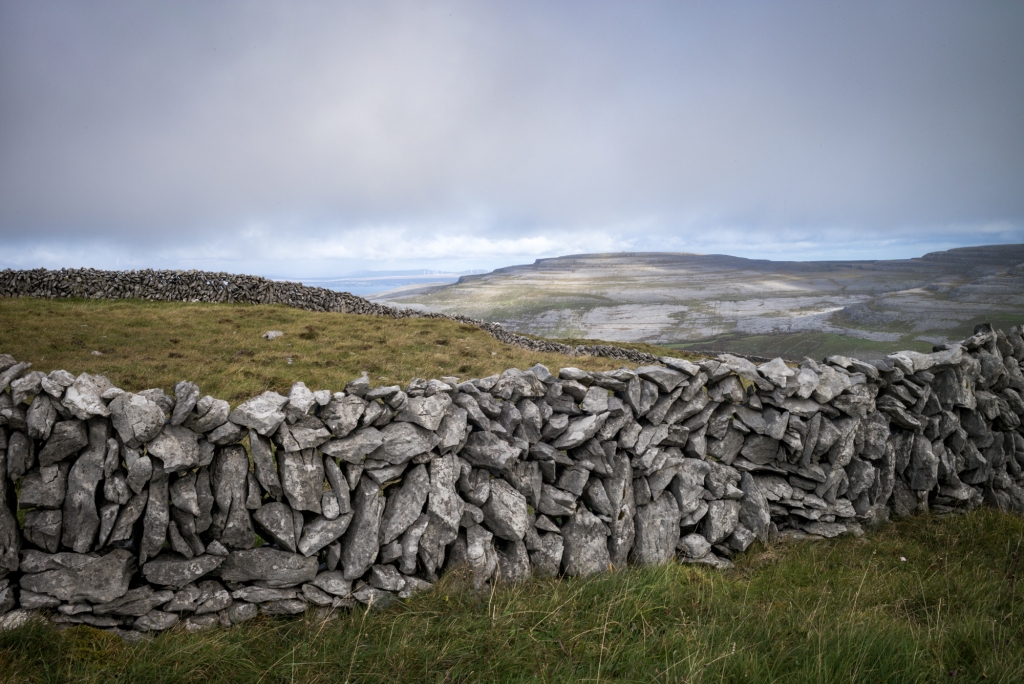
The dry stone walls of the Burren and Aran Islands are also pretty special. There’s no shortage of rock here of course, and building these walls served a dual purpose. Firstly, they would form enclosures for livestock, but the removal of rocks to construct the walls also cleared the grazing land of stone. The walls can be many kilometers long and seem to defy gravity. These loosely stacked, linear piles of rock seem so badly made that they could surely not survive. And yet, they have been around for centuries, surviving the weather and continuous farming use.

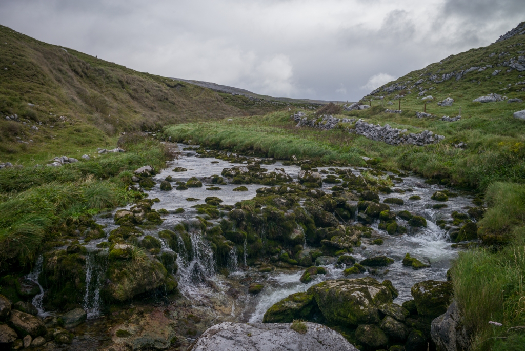
After walking up and over the plateau, the green road descends down into the Caher valley. Tucked away between the hills, and sheltered from the weather, the valley is green and wooded. The walk descends through the valley, following the course of the river and crossing it a couple of times.


The river that runs through the valley is the only consistent overground river system in the area as the riverbed is made of an impermeable boulder clay. Elsewhere in the Burren, the limestone means that rivers often run below ground.

The last few kilometers of the walk are all downhill and towards the sea – it’s a great way to finish off a walk. Fanore has a scruffy caravan park in the dunes above the beach and that tends to draw the eye. But this approach to the village brings small cottages, a church and the former RIC barracks (currently for sale), all with the constant soundtrack of the river noisily following the same route to the sea.

It’s a great walk – not too strenuous, not too remote, but with plenty of interest and some varied terrain. Here’s the route I took:


Further reading:
A walk on Mullaghmor
Landscape photography on the Burren
Making a lockdown zine

I could shoot images forever there! Beautiful shots!
LikeLiked by 2 people