In my last post, I described my photographic weekend, and my three days of photographing very different subject matter. The third of these trips was a drive around the Beara Peninsula in South West Ireland, and I felt that the results warranted a blog post of their own.
Beara sits below the more famous Dingle and Iveragh (home of the Ring of Kerry) Peninsulas and has a very different feel. There are not the high(ish) mountains of Iveragh nor as many people as Dingle. Instead, the countryside is made up of bare fields of exposed rock, surrounded by a long and varied coastline. There is a road that runs around the coastline of the peninsula and just two roads that cross from north to south, both travelling over spectacular passes.

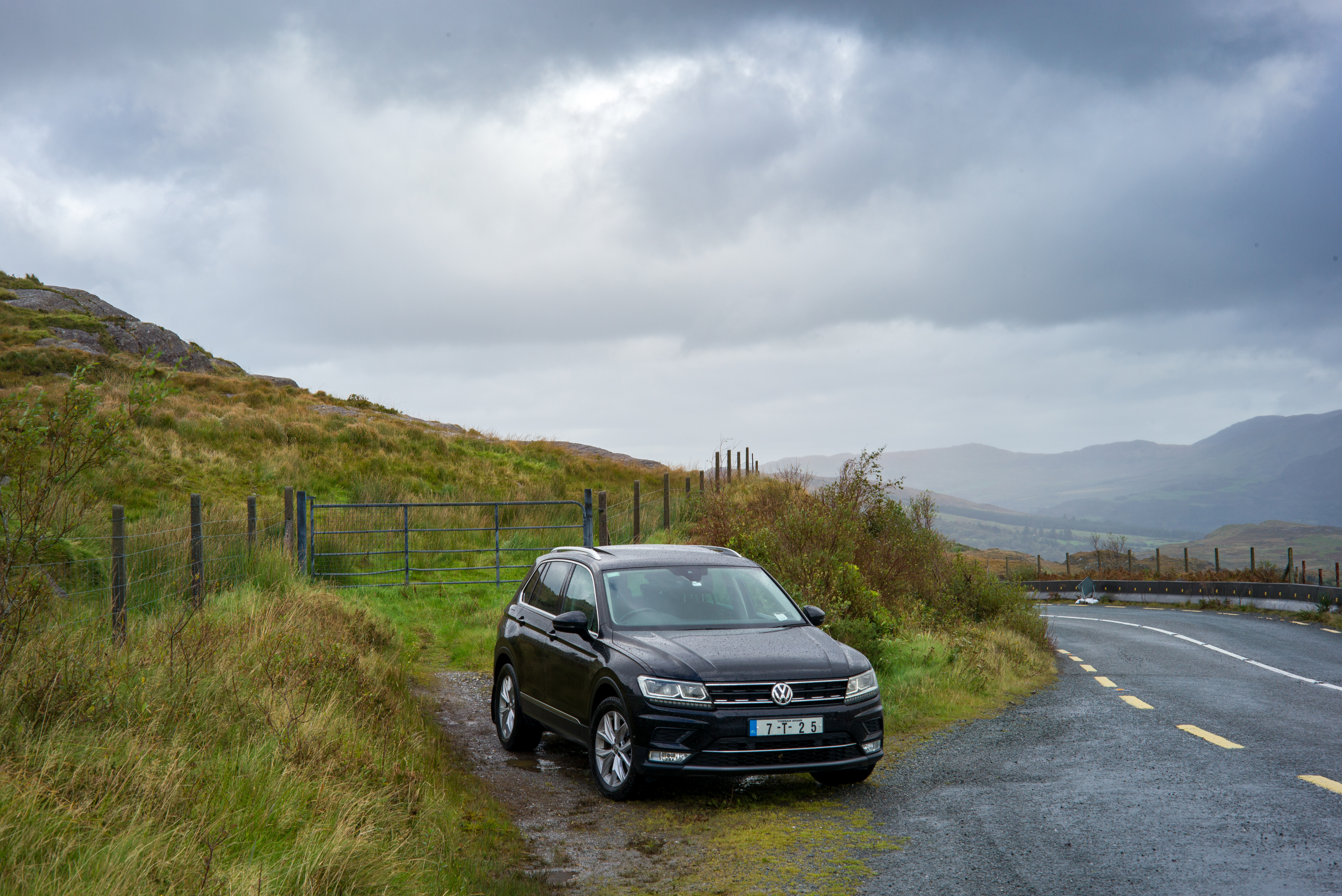
I drove to Glengarriff, the southern starting point of the ‘Ring of Beara’. From there, I followed this coast-hugging route for much of the day, with diversions off to see the Healy Pass and the fishing industrial estate at Castletownbere. By the time I was home, I’d driven for eight hours and covered 500km. I’d bought a new car a few days before the trip and so enjoyed the chance to spend some time getting to know it.

Between Kenmare and Glengarriff, the N71 road crosses from County Kerry to County Cork at the top of the Caha Pass. This road is classified as a National Route and yet is reduced to a single track as is passes through these tunnels on the way up the pass.

I’d visited Beara once before. I’d been to Kenmare to buy a kayak and spent the rest of the day driving through torrential rain, hoping for any kind of view of the area. While I was there I’d driven up the Healy Pass but not been able to open the car door, so strong was the wind at the top.
This time around, the weather was a little more benign. The showers were blowing through quickly on a strong wind, but between them, there was time to take a few pictures, only improved by the dramatic skies.

Back onto the road that runs around the edge of the peninsula, I stopped off at Castletownbere to see (what I assume is) a man-made island, covered by an industrial estate that seems to be home to a large part of the Irish fishing industry. A fleet of fishing boats were lined up in the harbour and nets stretched out across parts of the island for repair. Large warehouses were presumably for processing the catch as it arrives, and even on a Sunday with everything locked up, the whole pla(i)ce smelt terrible.
I missed out a visit to Dursey Island, that sits of the extreme western end of the peninsula and is connected by Ireland’s only cable car. I was short on time and expected that the cable car would not be running in the strengthening winds. Instead, I called in at a number of beaches and small bays to watch the waves hammering in from the Atlantic, before making my way to Allihies.
Allihies is a pretty village of colourful houses. In the hills above the village is extensive evidence of the copper mining that used to take place here. Copper was discovered when a sharp-eyed local spotted a purple line running through the rocks of the cliffs at the shore. The mining began in these cliffs in what must have been tremendously challenging conditions as the shafts had to be constantly pumped free of sea water that flooded them, using basic pumps imported from Cornwall.
The seam was worked inland and uphill between 1812 and 1886. Today, there are cavernous holes and bottomless drops all across the hillside, now protected by fences. Two mine buildings are still standing, including this most photogenic engine house.

By now, I was running out of time and needed to begin the three and a half hour drive home. Beara is the sort of place that one could dedicate a lifetime to photographing (indeed, I bought a book from a guy who seems to have done just that. Check out the website of Norman McLoskey) but I had to make do with pulling the car over whenever I saw a shot, and firing off a few frames.

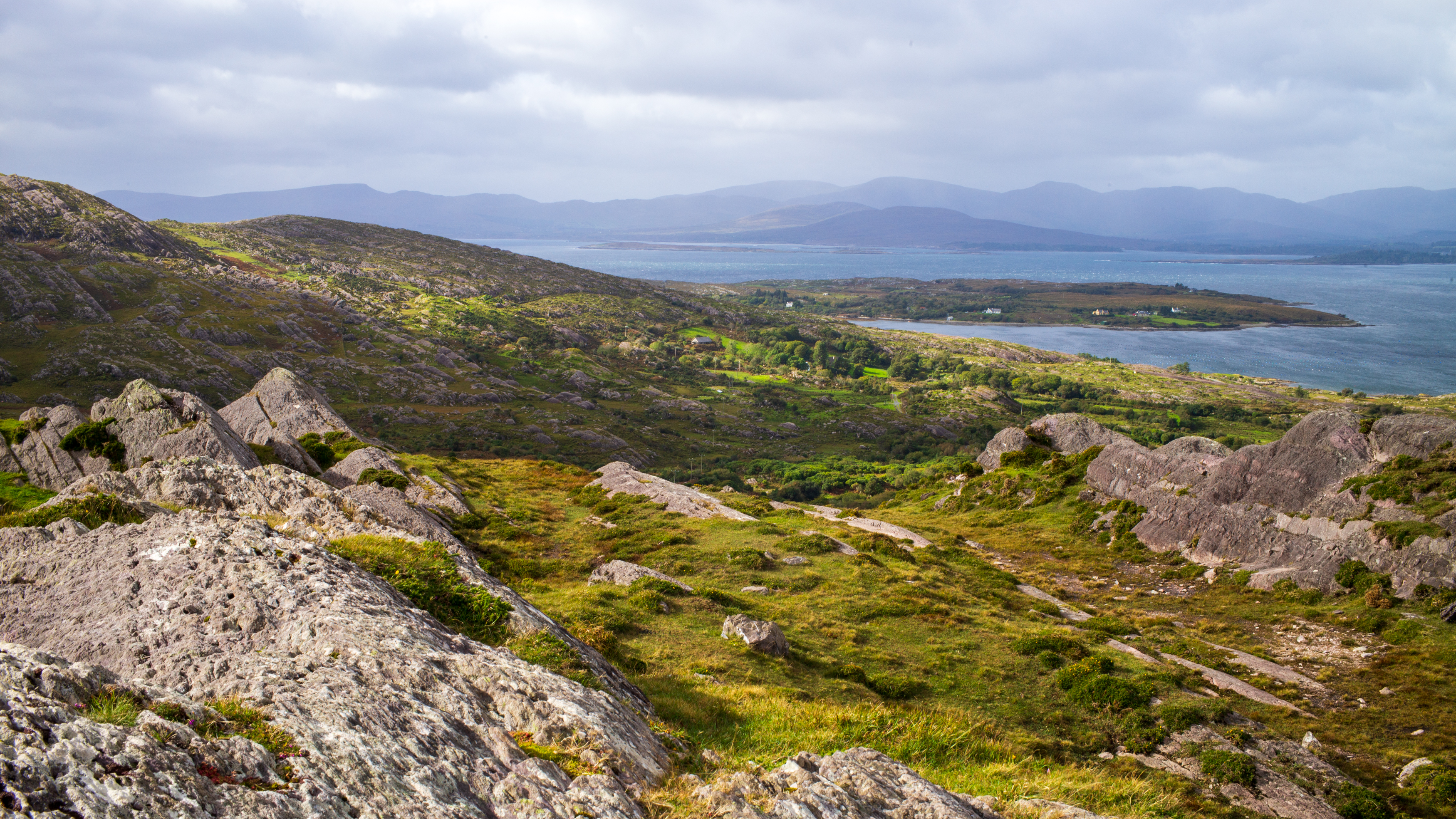
The drive back along the northern coastline of Beara is spectacular with views across the Kenmare ‘River’ (that’s really a wide bay) towards Kerry and the higher mountains of the McGillicuddy Reeks.

At one point of the drive, I saw a sign for Cashelkeelty stone circle and an empty lay-by. A finger post pointed invitingly over a stone wall and into some dense woodland. I decided to investigate, imagining a mysterious megalithic structure buried deep in the dark woods. It actually turned out to be a trek up a steep slope to a fairly disappointing scattering of stones. But as I turned around to start back down, the view across the river to the Ring Of Kerry was spectacular and well worth my very elevated heart rate.
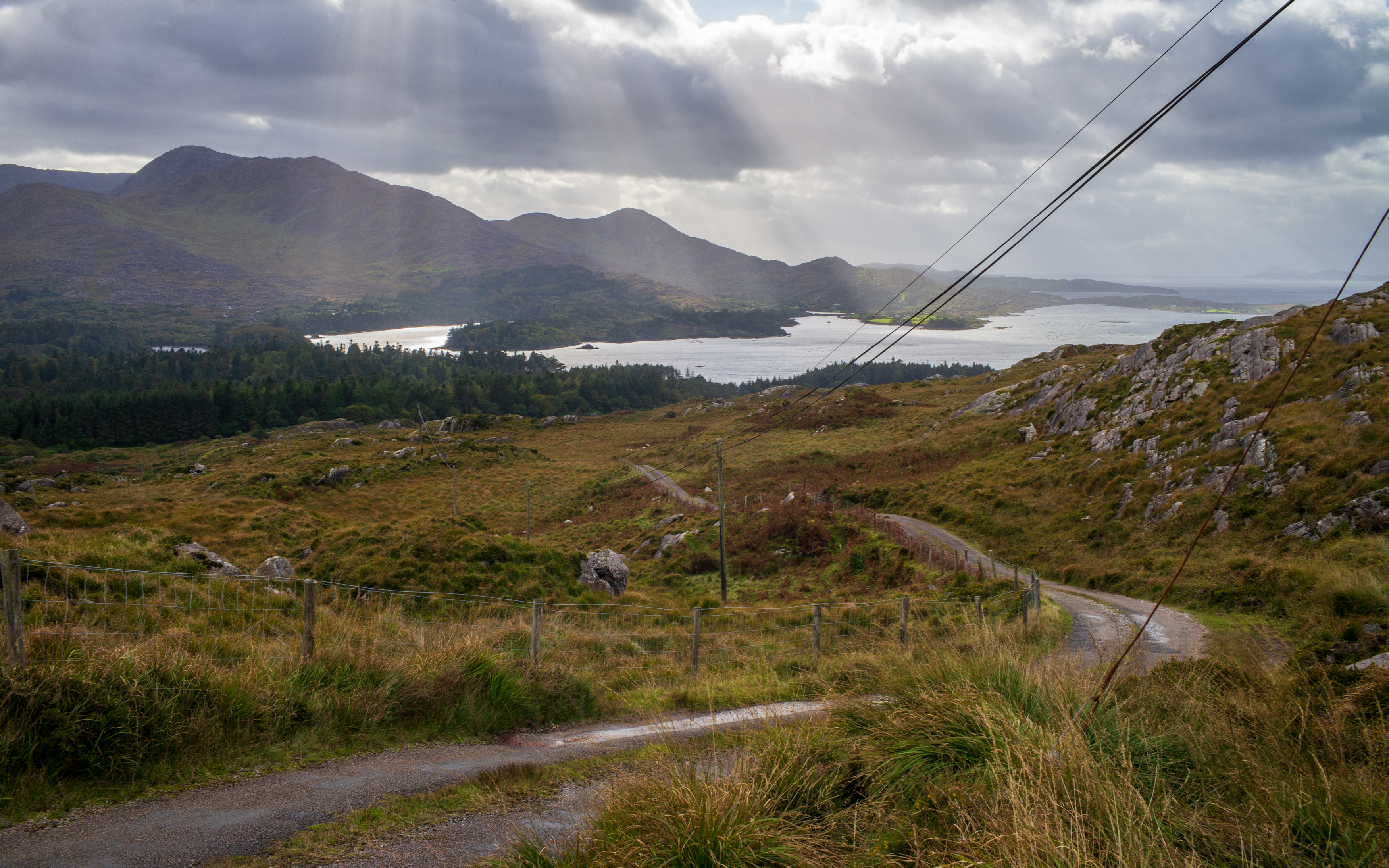
Whenever I’m exploring my new homeland of Ireland, I tend to rely on GoogleMaps to find my way around. My new car (did I mention it?) has built in navigation and so I thought I’d give that a go on the way home. At one point, it turned me off the obvious route and sent me off up a hillside that may have been a shorter distance, but was almost certainly not a quicker one. However, for the second time in just a few miles, an unexpected turn brought me to a spectacular view. As I drove up a tiny road, out of the trees and onto higher ground, I saw this view appear in my mirrors.
It was a great day out and a reminder of how lucky I am to have all this on my doorstep. Unfortunately, two days after this trip Ireland re-entered CoronaVirus lockdown and I can no longer travel outside of County Clare. At least this trip satisfied my need for exploration for a while at least. It also satisfied my need to take pictures…
Gubbins:
All pictures taken with a Leica M (typ262) and a selection of lenses.

Fantastic landscape and wonderful images. Your description makes me sure to visit this part next time 🤗
LikeLiked by 1 person